Worldwide Administrative
and Postcode Boundaries
Enterprise-ready boundary data with edge-matched polygons covering 247 countries.
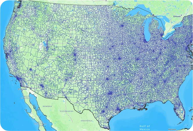
United States
boundary database

Global coverage
Extensive country coverage, including hard-to-source geographies like China, Japan, Brazil, and Russia.

Edge-matched polygons
Our proprietary topological model ensures shape accuracy. No gaps, no overlaps, no duplicate data.

High precision
Accurate mapping of the world at every level, up to 1-meter precision.
coverage
| Country | Postal Codes | Regions | Cities | Admin Levels |
|---|---|---|---|---|
| United States | 41,353 | 3,197 | 53,436 | 2 |
| United Kingdom | 1,791,707 | 402 | 32,061 | 4 |
| Germany | 26,336 | 4,723 | 13,101 | 4 |
| France | 16,050 | 35,232 | 39,597 | 4 |
| Canada | 898,855 | 326 | 8,350 | 2 |
| Australia | 2,949 | 574 | 16,192 | 2 |
Use cases for boundary data
From shipping optimization to market analysis, our boundary data powers
key operations

Territory Mapping
Define and manage sales territories using accurate postal code and administrative boundaries.

Reporting and Business Intelligence
Ensure accurate and consistent reports across your organization. Enhance data analysis with location intelligence.

Geofencing
Define geofences that trigger alerts and
automate location-based campaigns with
meter-level accuracy.

Map and Visualization
Analyze complex trends and discover actionable insights. Build engaging and intuitive map-based data visualizations.

Network Design
Optimize shipping routes and design efficient logistics networks for operational excellence.

Risk Management
Map natural hazard risk areas to identify addresses at risk and minimize avoidable losses.
Trusted by industry leaders
Join more than 100 enterprise clients who trust GeoPostcodes for their location data
Anjo Grebe
Consultant

Dr. Peter Wild
Managing Partner

Kousha Mazloumi
Director of Data Science
Kousha Mazloumi
Director of Data Science

William Chao
Product Owner of Geographic Information Services

Kate Kilby
Senior Product Manager

Dave Hamm
Project Manager


Kavian Ranjbar
Data Governance Specialist

Nick Beaugié
Senior Software Engineer
Why choose GeoPostcodes

Global coverage
Complete coverage across 247 countries, including hard-to-source geographies like China, Japan, Brazil, and Russia.

Highest quality
Built on extensive, authoritative sourcing with robust data engineering and quality control. Standardized and up-to-date.

Expert Consulting
With 15 years of experience, we guide your implementation and deliver data in the format that fits your system.
Frequently Asked Questions
Postcode boundaries represent geographic outlines associated with postal delivery regions. These areas are designed for routing and mail processing—not for defining official city, county, or state borders. Administrative borders are defined by governments, while Postcode boundaries are created for postal operations.
To understand how postal boundary systems work globally, see our Postal Boundaries product page.
The boundaries database includes multiple levels of administrative geography—from country down to subnational divisions—along with Postcode boundaries at granular scales. These layers help analysts relate postal regions to administrative units, post office jurisdictions, sectional center facility regions, and Census-style geographic structures.
You can explore administrative hierarchy examples on our Postcode boundaries product page.
An edge-matched polygon is a clean, non-overlapping shape whose borders align perfectly with neighboring shapes. In Postcode boundary datasets, edge-matching ensures that each POSTCODE polygon connects seamlessly to adjacent regions—avoiding gaps, slivers, or overlaps that can distort coverage maps.
Our boundaries are fully edge-matched and optimized for GIS workflows. Learn more on the Postal Boundaries product page.
The best geographic level depends on your use case:
- Statistical analysis: Postcode Tabulation Areas (ZCTAs) or larger administrative levels
- Routing or logistics: Five-digit Postcode boundaries or delivery-route-oriented postal geographies
- Local analysis: The smallest available Postcode geography
- Infrastructure, planning, or demographic context: Higher-level administrative divisions
If you need population-based or demographic alignment, see our Population Data product.
Yes. Our Postcode boundaries and administrative layers are provided in industry-standard formats (GeoJSON, Shapefile, GeoPackage), ensuring seamless integration with ArcGIS, QGIS, and all major GIS platforms. Users can visualize postal regions, overlay Census datasets, and connect POSTCODE polygons to street and address datasets.
For GIS-ready data formats and details, see the Postal Boundaries product page.