
Global population
by ZIP code
One dataset combining population, and ZIP code data.
Standardized across every market.






Our population data samples
| iso | zip code | pop1975 | pop2025 | pop2030 | square_km |
|---|---|---|---|---|---|
| US | 10001 | 20022 | 23542 | 24227 | 1.627949 |
| US | 10002 | 72117 | 84905 | 87546 | 2.129734 |
| US | 10003 | 49926 | 58273 | 60294 | 1.475585 |
| US | 10004 | 3038 | 3555 | 3744 | 1.111534 |
| US | 10005 | 6277 | 7244 | 7459 | 0.160261 |
| US | 10006 | 2338 | 2914 | 2927 | 0.250328 |
| US | 10007 | 6369 | 7433 | 7647 | 0.414131 |
| US | 10009 | 53489 | 62878 | 64796 | 1.597301 |
| US | 10010 | 26503 | 31058 | 32074 | 0.955077 |
| US | 10011 | 44834 | 52722 | 54376 | 1.670544 |
| US | 10012 | 21336 | 25096 | 25858 | 0.838118 |
| US | 10013 | 23764 | 27800 | 28672 | 1.411006 |
| US | 10014 | 27986 | 33036 | 34049 | 1.254836 |
| US | 10016 | 48872 | 57263 | 59442 | 1.418998 |
| US | 10017 | 12851 | 15182 | 15619 | 0.775065 |
| US | 10018 | 4929 | 5918 | 5953 | 0.888766 |
| US | 10019 | 35417 | 41706 | 43062 | 1.697855 |
| US | 10020 | 57 | 71 | 81 | 0.060382 |
| US | 10021 | 38116 | 44796 | 46234 | 0.923488 |
| US | 10022 | 28967 | 34014 | 35045 | 1.140709 |
| US | 10023 | 56022 | 65723 | 67577 | 2.605523 |
| US | 10024 | 53131 | 62383 | 64565 | 2.697514 |
| US | 10025 | 83909 | 98742 | 101632 | 2.302129 |
| US | 10026 | 30553 | 35819 | 37082 | 0.992729 |
| US | 10027 | 51848 | 60853 | 63043 | 2.441945 |
| US | 10028 | 39231 | 46064 | 47671 | 0.819919 |
| US | 10029 | 68273 | 80124 | 82897 | 3.036337 |
| US | 10030 | 24113 | 28184 | 29062 | 0.71811 |
| US | 10031 | 50144 | 58796 | 60670 | 1.733068 |
| US | 10032 | 51784 | 60757 | 62820 | 1.742147 |
| US | 10033 | 46415 | 54473 | 56078 | 1.5448 |
| US | 10034 | 34583 | 40731 | 42114 | 2.659349 |
| US | 10035 | 29220 | 34460 | 35311 | 3.63805 |
| US | 10036 | 22003 | 25781 | 26711 | 1.158341 |
| US | 10037 | 15032 | 17632 | 18235 | 0.602984 |
| US | 10038 | 16992 | 19906 | 20406 | 0.732491 |
| US | 10039 | 20831 | 24588 | 25302 | 0.774862 |
| US | 10040 | 37014 | 43635 | 45038 | 1.468524 |
| US | 10041 | 0 | 1 | 1 | 0.011221 |
| US | 10043 | 181 | 215 | 220 | 0.00536 |
| US | 10044 | 9628 | 11294 | 11717 | 0.595877 |
| US | 10045 | 134 | 142 | 156 | 0.003071 |
| US | 10055 | 2 | 3 | 3 | 0.003453 |
| US | 10060 | 1 | 1 | 0 | 0.000324 |
| US | 10065 | 28159 | 33164 | 34183 | 1.08543 |
| US | 10069 | 3301 | 3880 | 4020 | 0.106198 |
| US | 10075 | 24304 | 28529 | 29534 | 0.489567 |
| US | 10080 | 130 | 396 | 393 | 0.009949 |
| US | 10081 | 220 | 239 | 257 | 0.011246 |
| US | 10090 | 7 | 5 | 7 | 0.005125 |
| ISO | Country | Language | Pop | Level | Type | Name | Region1 | Region2 | Region3 | ISO2 | gpc_id |
|---|---|---|---|---|---|---|---|---|---|---|---|
| NZ | New Zealand | EN | 5291198 | 0 | Country | New Zealand | 20150764 | ||||
| NZ | New Zealand | EN | 572978 | 1 | Regions | Greater Wellington | Greater Wellington | NZ-WGN | 20150834 | ||
| NZ | New Zealand | EN | 111791 | 2 | City Councils | Lower Hutt | Greater Wellington | Lower Hutt | NZ-WGN | 20150836 | |
| NZ | New Zealand | EN | 64836 | 2 | City Councils | Porirua | Greater Wellington | Porirua | NZ-WGN | 20150839 | |
| NZ | New Zealand | EN | 49015 | 2 | City Councils | Upper Hutt | Greater Wellington | Upper Hutt | NZ-WGN | 20150841 | |
| NZ | New Zealand | EN | 59161 | 2 | District councils | Kapiti Coast | Greater Wellington | Kapiti Coast | NZ-WGN | 20150837 | |
| RO | România | RO | 19421307 | 0 | Country | România | 20162574 | ||||
| RO | România | RO | 2340334 | 1 | Regiuni | București - Ilfov | București - Ilfov | 20162575 | |||
| RO | România | RO | 1881190 | 2 | National capital | București | București - Ilfov | București | RO-B | 20162576 | |
| RO | România | RO | 228653 | 3 | Sectoarele municipiului | București - Sectorul 1 | București - Ilfov | București | București - Sectorul 1 | RO-B | 20162577 |
| RO | România | RO | 349283 | 3 | Sectoarele municipiului | București - Sectorul 2 | București - Ilfov | București | București - Sectorul 2 | RO-B | 20162578 |
| TR | Türkiye | TR | 86495428 | 0 | Country | Türkiye | 20178761 | ||||
| TR | Türkiye | TR | 14507346 | 1 | Coğrafi bölgeleri | İç Anadolu | İç Anadolu | 20180346 | |||
| TR | Türkiye | TR | 6351239 | 2 | Büyükşehir Belediyeler | Ankara | İç Anadolu | Ankara | TR-06 | 20180377 | |
| TR | Türkiye | TR | 531703 | 3 | Büyükşehir İlçe Belediyeler | Altındağ | İç Anadolu | Ankara | Altındağ | TR-06 | 20180380 |
| TR | Türkiye | TR | 784115 | 3 | Büyükşehir İlçe Belediyeler | Çankaya | İç Anadolu | Ankara | Çankaya | TR-06 | 20180400 |
| TR | Türkiye | TR | 958632 | 3 | Büyükşehir İlçe Belediyeler | Mamak | İç Anadolu | Ankara | Mamak | TR-06 | 20180462 |
| TR | Türkiye | TR | 466637 | 3 | Büyükşehir İlçe Belediyeler | Yenimahalle | İç Anadolu | Ankara | Yenimahalle | TR-06 | 20180491 |
| TZ | Tanzania | EN | 71370093 | 0 | Country | Tanzania | 20182778 | ||||
| TZ | Tanzania | EN | 3029790 | 1 | Mkoa | Dodoma | Dodoma | TZ-03 | 20182779 | ||
| TZ | Tanzania | EN | 582032 | 2 | Wilayas | Dodoma TC | Dodoma | Dodoma TC | TZ-03 | 20182896 | |
| UA | Ukraine | EN | 38744087 | 0 | Country | Ukraine | 20186415 | ||||
| UA | Ukraine | EN | 2589241 | 1 | Special municipalities | Kyiv | Kyiv | UA-30 | 20187109 | ||
| UA | Ukraine | EN | 2589241 | 2 | Cities | Kyiv | Kyiv | Kyiv | UA-30 | 20187120 | |
| UA | Ukraine | EN | 2589241 | 3 | Municipalities | Kyiv | Kyiv | Kyiv | Kyiv | UA-30 | 66475799 |
| UA | Україна | UK | 38744087 | 0 | Country | Україна | 20186415 | ||||
| US | United States | EN | 343482526 | 0 | Country | United States | 20188365 | ||||
| US | United States | EN | 7210139 | 1 | States | Massachusetts | Massachusetts | US-MA | 20189603 | ||
| US | United States | EN | 266679 | 2 | Counties | Barnstable | Massachusetts | Barnstable | US-MA | 20189604 | |
| US | United States | EN | 162810 | 2 | Counties | Berkshire | Massachusetts | Berkshire | US-MA | 20189605 | |
| US | United States | EN | 658917 | 2 | Counties | Bristol | Massachusetts | Bristol | US-MA | 20189606 | |
| UY | Uruguay | ES | 3415392 | 0 | Country | Uruguay | 20191570 | ||||
| UY | Uruguay | ES | 1350302 | 1 | Departamentos | Montevideo | Montevideo | UY-MO | 20191580 | ||
| ZA | Suid-Afrika | AF | 61664553 | 0 | Country | Suid-Afrika | 20205732 | ||||
| ZA | Suid-Afrika | AF | 16792277 | 1 | Provinsies | Gauteng | Gauteng | ZA-GP | 20205800 | ||
| ZA | Suid-Afrika | AF | 3987683 | 2 | Metropolitaanse Munisipaliteit | Stad Tshwane | Gauteng | Stad Tshwane | ZA-GP | 20205802 | |
| ZA | Suid-Afrika | AF | 84856 | 3 | Main places | Akasia | Gauteng | Stad Tshwane | Akasia | ZA-GP | 60757321 |
| ZA | Suid-Afrika | AF | 87937 | 3 | Main places | Atteridgeville | Gauteng | Stad Tshwane | Atteridgeville | ZA-GP | 60757329 |
| ZA | Suid-Afrika | AF | 205 | 3 | Main places | Babelegi | Gauteng | Stad Tshwane | Babelegi | ZA-GP | 60757298 |
| ZA | South Africa | EN | 139722 | 3 | Main places | Saulsville | Gauteng | City of Tshwane | Saulsville | ZA-GP | 60757314 |
| ZA | South Africa | EN | 545206 | 3 | Main places | Soshanguve | Gauteng | City of Tshwane | Soshanguve | ZA-GP | 60757341 |
| ZA | South Africa | EN | 3395 | 3 | Main places | Soutpan | Gauteng | City of Tshwane | Soutpan | ZA-GP | 60757283 |
| ZA | South Africa | EN | 55759 | 3 | Main places | Stinkwater | Gauteng | City of Tshwane | Stinkwater | ZA-GP | 60757282 |
| ZA | South Africa | EN | 15946 | 3 | Main places | Suurman | Gauteng | City of Tshwane | Suurman | ZA-GP | 60757296 |
| ZA | South Africa | EN | 82998 | 3 | Main places | Temba | Gauteng | City of Tshwane | Temba | ZA-GP | 60757287 |
| ZA | South Africa | EN | 2586 | 3 | Main places | Thembisile | Gauteng | City of Tshwane | Thembisile | ZA-GP | 60757342 |
| ZA | South Africa | EN | 1664 | 3 | Main places | Tierpoort | Gauteng | City of Tshwane | Tierpoort | ZA-GP | 60757300 |
| ZA | South Africa | EN | 4010 | 3 | Main places | Tsebe | Gauteng | City of Tshwane | Tsebe | ZA-GP | 60757286 |

Global coverage
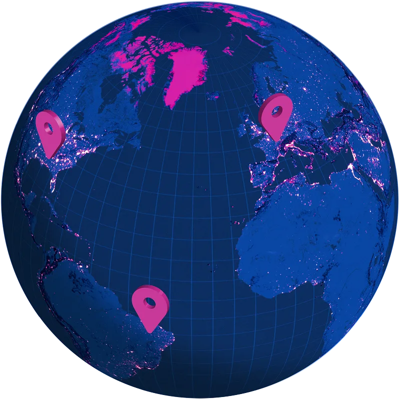
Extensive country coverage, including hard-to-source geographies like China, Japan, Brazil, and Russia.

Accurate ZIP code mapping
Population data is available for ZIP codes and regions, and standardized across geographies.

Population trends
55 years of historical and future population data at 5-year intervals.
Key features of our global population by ZIP code database

Population density
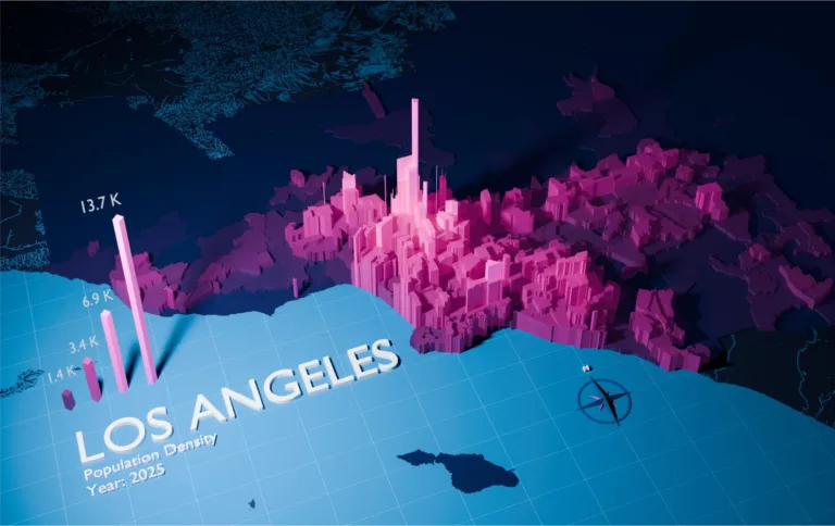
Leverage population trends which record changes in population density, tracks migration, and urbanization patterns over a significant period.
"We spot check our customers’ establishment presence per area with real population data. Doing so, we may find out the area has a low population density but a high establishment density."

Kousha Mazloumi
Director of Data Science, Brizo by Datassential

Accurate at any level of granularity
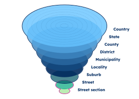
Obtain population estimates based on ZIP code or up to 4 administrative levels depending on your use case.

Historical and future trends
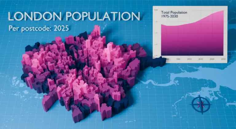
Population data spans over 55 years including past, present, and future insights at 5-year intervals.
"GeoPostcodes’ Population data shows population forecasts over the next years. We can use it as a proxy to justify longer-term changes and downgrade postal code areas in terms of economic viability."
Kousha Mazloumi
Director of Data Science, Brizo by Datassential

Standardized and reliable
Our data has a unified global structure. The file formats, column titles, attribute naming, and data model are consistent across countries.


Rich attributes
Our population by ZIP code data can be enriched with country-specific information, cities, time zones, multi-language, UNLOCODE, and IATA codes.

Self-hosted
Self-hosted delivery for enhanced security, compliance, and performance at a fixed cost, no matter the volume.
Why choose self-hosted delivery"We replaced costly APIs and simplified our location data management thanks to GeoPostcodes. Life without it would be complicated."

Nick Beaugié
Senior Software Engineer, Randstad

Use cases for the global population by ZIP code database
Powering enterprise solutions and product innovation for businesses worldwide

Site selection analysis
Rank neighborhoods and cities based on population density to prioritize locations for retail investment.

Market expansion
Identify growing markets, assess their business potential, and extract insights for an effective expansion strategy.

Audience profiling
Perform rural and urban classification based on population density and build consistent geographic segments across markets.

Predictive modeling
Use population density to assess economic viability and market saturation at the ZIP code level.

Geomarketing
Map population figures to ZIP codes to identify high-density target areas and enable accurate geographic segmentation.

Territory mapping
Map sales areas and identify zones where there is untapped potential.
Trusted by industry leaders
Join more than 100 enterprise clients who trust GeoPostcodes for their location data


Anjo Grebe
Consultant


Dr. Peter Wild
Managing Partner

Kousha Mazloumi
Director of Data Science

Kousha Mazloumi
Director of Data Science


William Chao
Product Owner of Geographic Information Services


Kate Kilby
Senior Product Manager


Dave Hamm
Project Manager


Kavian Ranjbar
Data Governance Specialist

Nick Beaugié
Senior Software Engineer
Why choose GeoPostcodes

Global coverage
Complete coverage across 247 countries, including hard-to-source geographies like China, Japan, Brazil, and Russia.

Highest quality
Built on extensive, authoritative sourcing with robust data engineering and quality control. Standardized and up-to-date.

Expert Consulting
With 15 years of experience, we guide your implementation and deliver data in the format that fits your system.
Data dictionary
Comprehensive field definitions and data specifications from the Population Database
| Field name | Field type | Description |
|---|---|---|
| ISO | Char(2) | ISO 3166-1 country code |
| Country | Char(50) | Country name |
| Language | Char(2) | Language code |
| ID | Integer | Record identifier |
| Pop | Integer | Population living in the postal code area or in the administrative division |
| Square_km | Double | Surface area covered by the postal code or the administrative division, in square kilometers |
| Postcode | Char(15) | ZIP / Postal code |
| Name | Char(80) | Administrative division name |
| Level | Integer | Contains a value ranked from 0 to 4 to define the administrative division level, from the largest to the smallest |
| Type | Char(50) | Type of administrative division |
| Region 1 | Char(80) | Administrative division level 1 |
| Region 2 | Char(80) | Administrative division level 2 |
| Region 3 | Char(80) | Administrative division level 3 |
| Region 4 | Char(80) | Administrative division level 4 |
How to integrate our self-hosted database
Flexible deployment, and seamless integration, all within your own infrastructure.
Choose your delivery method
Select the delivery option that fits your infrastructure.
Download the full database directly from your Customer Portal.
Retrieve the full files via API for automated ingestion into your pipeline.
Access the data in your cloud environment: Snowflake, Azure Data Share or AWS.
Integrate into your system
Import the data easily into any software, database, ERP, CRM, MDM, GIS, BI and GIS system.











Complete your location data suite
ZIP code database
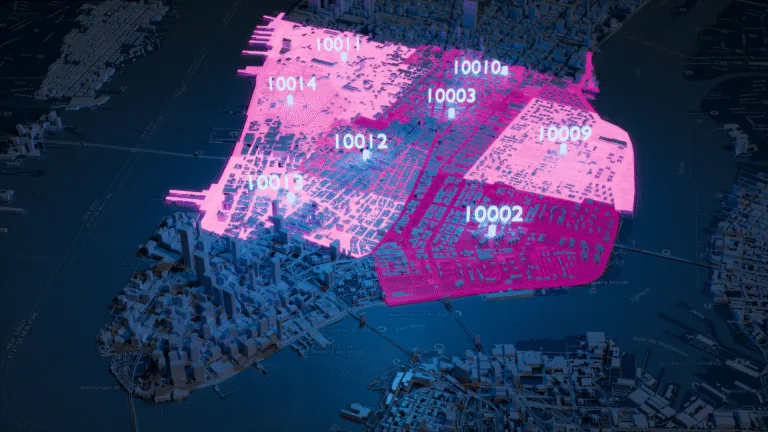
Global dataset containing all administrative divisions, cities and ZIP codes for 247 countries.
Explore the database
Boundary data
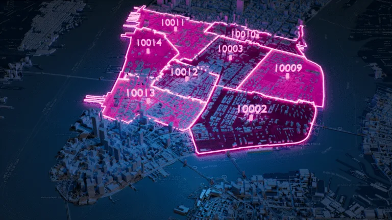
A global data set of polygons representing postal codes and administrative areas.
Explore the database

Address database
International street data including standardized address formats, administrative divisions, cities, and ZIP codes.
Explore the database
Frequently Asked Questions
Historical population estimates depend on the source methodology. GeoPostcodes provides global population data linked to ZIP codes, postal codes, and administrative divisions, with coverage spanning multiple decades. Public datasets—such as those from the United States Census Bureau—use the decennial census or the American Community Survey to generate aggregated demographic data.
Our global dataset fills international gaps using trusted sources and interpolation techniques. You can explore the historical year coverage on our Population Data product page.
Yes. Our dataset includes forward-looking population projections for many regions. While public U.S. datasets such as ACS and Census ZCTAs report historical or current values, our global population dataset provides long-term projections even for countries that do not use ZIP Code Tabulation Areas.
These projections help teams understand how populations evolve across ZIP codes, postal codes, and administrative subdivisions. Learn more in the Population Data product details.
Organizations rely on ZIP-level and postal-code-level population counts for:
- Market sizing
- Demand forecasting
- Demographic segmentation
- Planning and territory optimization
- Site selection and service-area modeling
Analysts often combine demographic indicators—such as median age, household structure, or age ranges—with postal geographies to support planning projects. When working in the U.S., population counts at ZIP level are often compared with ZCTA-based ACS data, keeping in mind that ZCTAs are statistical approximations.
For more on how geography and postal structures support demographic analysis, see Zip Code Analysis.
You can match population values by joining ZIP code or administrative identifiers to geographic shapes such as polygons or shapefiles.
- ZCTAs (from the Census Bureau) are designed for statistical analysis
- USPS ZIP codes are designed for operational routing and do not act as demographic units
Because ZIPs and ZCTAs differ, analysts must choose the correct geography based on whether they prioritize delivery accuracy or demographic precision.
For boundary layers compatible with ZIP-based or admin-based analysis, see our Postal and Administrative Boundaries products.
No. USPS ZIP codes are built for postal routing, not demographic reporting. The Census Bureau creates ZIP Code Tabulation Areas (ZCTAs) to approximate ZIP-based population statistics. ZCTAs may:
- Include areas not served by the USPS
- Exclude boundaries used in routing
- Generalize shapes that don’t correspond to real delivery zones
Because ZIPs and ZCTAs differ, analysts must choose datasets based on their needs: operational routing (ZIPs) or demographic estimation (ZCTAs).
For a clear overview of the differences between postal and statistical geographies, see our guide ZIP Code vs Postcode: Key Differences.