
The most comprehensive world
postal code database
Complete, accurate, and always up-to-date






Our Products
Postal data for every enterprise
Worldwide Postal Database
A truly global dataset containing all administrative divisions, cities, and world postal codes for 247 countries.
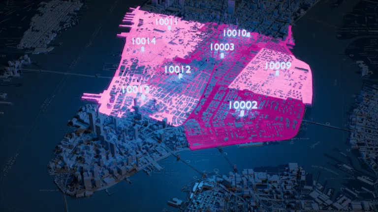
Boundary Data
A global dataset of polygons representing postal codes and administrative divisions.

Address Database
International dataset with all administrative divisions, cities, streets, and ZIP codes.

Population Database
Global population estimates at ZIP code and administrative level covering a span of 55 years: past, present, and future.

GLOBAL COVERAGE
Most popular countries for ZIP code data
Explore our top countries for ZIP code data. You can also visit the country hub to view all available countries.


All postal code data you need
Since 2009, we’ve mapped the world postal codes so you don’t have to.
Years of accumulated insights have helped us to develop our unified, proprietary database containing the most extensive world postal dataset worldwide.
It comes with advanced features, including support for multilingual and cross-cultural operations.
All data are fully georeferenced, available in normalized and denormalized formats, and easy to import into any software, database, or GIS system for maximum interoperability.
247 Countries
316K Administrative areas
9,3M Postal/Zip codes
4M Cities and Towns
116K UNLOCODES
15,9M Coordinates
299 Languages
880K Boundaries
401 Time zones
29M Street section coordinates
Trusted by industry leaders
Join more than 100 enterprise clients who trust GeoPostcodes for their location data


Anjo Grebe
Consultant


Dr. Peter Wild
Managing Partner


Kousha Mazloumi
Director of Data Science

Kousha Mazloumi
Director of Data Science


William Chao
Product Owner of Geographic Information Services


Kate Kilby
Senior Product Manager


Dave Hamm
Project Manager


Kavian Ranjbar
Data Governance Specialist


Nick Beaugié
Senior Software Engineer
Why choose GeoPostcodes

Global coverage
Complete coverage across 247 countries, including hard-to-source geographies like China, Japan, Brazil, and Russia.

Highest quality
Built on extensive, authoritative sourcing with robust data engineering and quality control. Standardized and up-to-date.

Expert Consulting
With 15 years of experience, we guide your implementation and deliver data in the format that fits your system.
8,5 million world postal codes in a single downloadable database
Designed for
enterprise integration
up-to-date
Complete, accurate
and always
up-to-date
Tackling world postal code challenges to solve enterprise use cases.
Whether improving master data quality, integrating global address validation, handling postal code systems, postal code formats, and zip code formats, or building location-aware products, enterprises struggle to access reliable global postal code and location master data.
Teams waste weeks sourcing local postal service providers, reconciling diverse dataset file formats, fixing postal code data quality, aligning zip codes and postal codes, and managing multiple languages and encodings.
GeoPostcodes simplifies global geodata, world postal code integration, and zip code normalization, so your teams can focus on core business innovation.
SOLUTIONS
Get the right data for your use case
Address Capture and Validation
Map and Visualization
Reporting and Business Intelligence
Master Data Management
Rely on a single source of truth to scale the quality of your location data. Ensure accuracy, consistency, and timeliness across your systems and organization.
Logistics and Shipping
Design and optimize your distribution network, plan your pick-up and drop-off locations, reduce costs and improve visibility over your shipping.
Market Research and Geomarketing
Segment your respondents and customers, design sales areas for site selection, retail analytics, and targeted campaigns.
Custom Package
We help you build a solution for your use-case.
Master Data Management
Logistics and Shipping
Sales & Marketing
Custom Package
Our best selection of articles for you













Accelerate your projects through dedicated integration
We take full care of the location data quality aspect of your project. This helps your team to focus on what matters most: executing on your use case. Our team has been helping enterprise customers with their ERP integrations, master data management projects, address validation, and custom product development since 2009. We leverage this experience to help you meet your deadlines in a cost-effective manner.
Frequently Asked Questions
GeoPostcodes provides the most comprehensive global location database. Our datasets include ZIP codes, addresses, boundaries, and population data.
- International ZIP Code Database: A single source of truth covering 247 countries and territories, enriched with cities, administrative divisions, and time zones, all accurately geocoded and delivered in a unified global structure.
- International Address Database: Street-level data in 81 countries and house number precision in 51 countries. Standardizes city definitions and address formats across 233 postal systems, with multi-language support for 299 languages.
- International Boundaries Database: Edge-matched polygons for ZIP codes and up to five administrative levels worldwide. Our proprietary topological model ensures clean geometries: no gaps, no overlaps, no duplicate data.
- Global Population Database: 55 years of historical and future population estimates, at 5-year intervals across 247 countries. Population figures are available at up to six levels of granularity, from ZIP codes to regions, within a standardized global structure.
GeoPostcodes covers 247 countries and territories, including hard-to-source geographies like China, Japan, Brazil, and Russia.
Every country is delivered within a unified global structure, so your team can easily add markets without changing how you handle the data.
Global location data supports a variety of use cases across operations, analytics, and customer experience:
- Address validation: Verify that addresses are complete, correctly formatted, and match local postal standards, in every country and every language.
- Address autocomplete: Suggest accurate and standardized addresses as users type to reduce input errors and improve user experience.
- Distance calculation: Compute distances between locations to power radius searches, routing decisions, shipping tariffs, mileage and CO₂ reporting for ESG, job-to-candidate matching, and location-based ad targeting.
- Logistics and shipping: Design and optimize your distribution network, enable cross-border shipping, and ensure delivery success.
- Reporting and business intelligence: Produce compliant and accurate reports across your organization, and enhance data analysis with location intelligence.
- Map visualization: Analyze complex trends and discover actionable insights. Build engaging map-based data visualizations.
- Master Data Management: Rely on a single source of truth to keep location data accurate, consistent, and current across your systems and organization.
- Sales and Marketing: Segment customers for site selection, analytics, geofencing, campaigns, territory mapping, and ad targeting.
GeoPostcodes delivers its data in text files (the most popular format is CSV) that you can easily integrate into your databases and processes. Hosting your own data gives you full control over security, compliance, and performance at a fixed cost, regardless of volume.
Choose the delivery method that fits your infrastructure best:
- Manual download: Download the full database from your secure space in the GeoPostcodes Customer Portal.
- Download API: Retrieve the files via API for automated ingestion into your pipeline.
- Cloud-to-cloud: GeoPostcodes syncs the data directly to your cloud environment (Snowflake, Azure Data Share, or AWS).
GeoPostcodes serves companies with a global footprint that need accurate location to streamline cross-border operations, obtain actionable insights, deliver better customer experiences, and reduce location-related costs.
Fortune 500 companies such as Amazon, DB Schenker (case study), MSC (case study), and Randstad (case study) use GeoPostcodes’ data to run address validation, distance calculation, and map visualization at global scale, supporting critical operations across logistics, e-commerce, advertising, market research, and marketplaces worldwide.
GeoPostcodes’ annual licenses are priced per product, based on the countries you need and your use case. The licenses include access to your data, ongoing updates, and support from a dedicated expert who guides the integration and answers your team’s questions.
Share your needs with our team, and we will prepare a proposal tailored to your project.
Every GeoPostcodes customer works with a dedicated Customer Success Manager who guides onboarding, integration, and ongoing adoption. With 15 years of experience, we provide technical support, help tailor datasets to your use case, and continuously maintain and update them to ensure accuracy and reliability.
Your Customer Success Manager acts as your trusted partner throughout your journey with GeoPostcodes.