Population by zip code - Past and future trends
Get global demographics data at administrative and zip code level
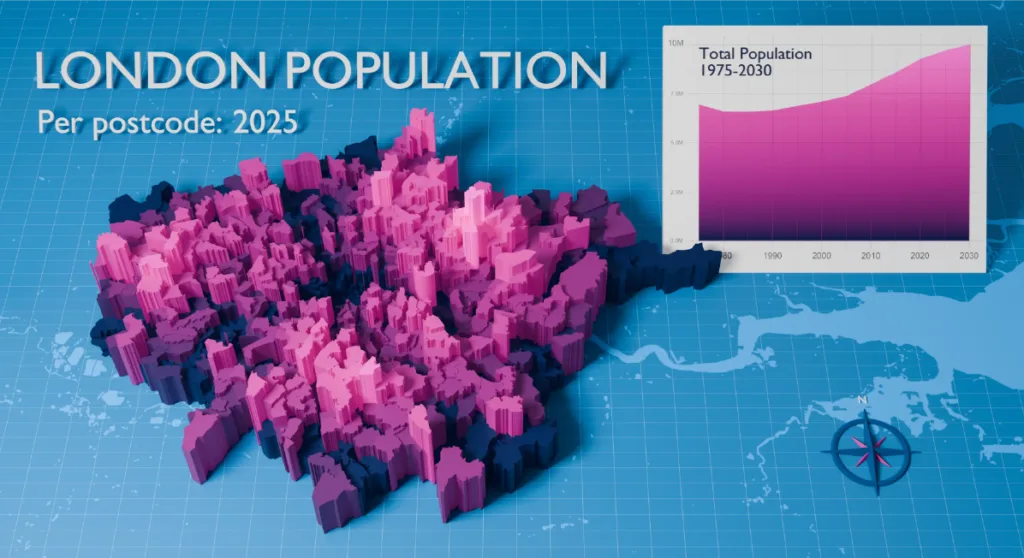
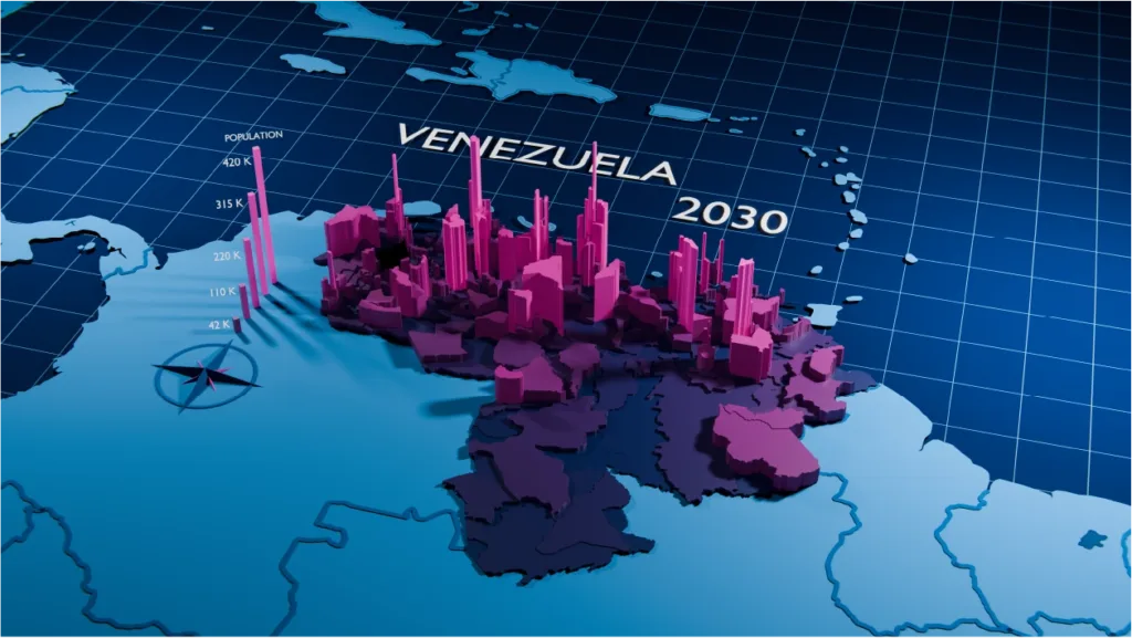


Our Population Data Samples
| ISO | Zip code | Pop1975 | Pop2025 | Pop2030 | square_km |
|---|---|---|---|---|---|
| US | 10001 | 20410 | 24018 | 24761 | 1.673 |
| US | 10002 | 72505 | 85387 | 88203 | 2.441 |
| US | 10003 | 49254 | 57454 | 59468 | 1.443 |
| US | 10004 | 3431 | 3942 | 4327 | 1.162 |
| US | 10005 | 4606 | 5458 | 5505 | 0.153 |
| US | 10006 | 1828 | 2253 | 2309 | 0.125 |
| US | 10007 | 109 | 128 | 141 | 0.008 |
| US | 10009 | 53319 | 62645 | 64454 | 1.477 |
| US | 10010 | 26517 | 31107 | 32099 | 0.907 |
| US | 10011 | 45360 | 53313 | 55025 | 1.729 |
| US | 10012 | 21658 | 25521 | 26304 | 0.854 |
| US | 10013 | 24420 | 28516 | 29353 | 1.447 |
| US | 10014 | 27105 | 31922 | 32949 | 1.316 |
| US | 10016 | 48079 | 56293 | 58275 | 1.412 |
| US | 10017 | 13330 | 15701 | 16274 | 0.893 |
| US | 10018 | 4530 | 5309 | 5436 | 0.818 |
| US | 10019 | 37314 | 43995 | 45363 | 1.732 |
| US | 10020 | 26 | 30 | 32 | 0.047 |
| US | 10021 | 40424 | 47473 | 49003 | 0.974 |
| US | 10022 | 29775 | 34962 | 35998 | 1.156 |
| US | 10023 | 54712 | 64127 | 66064 | 1.43 |
| US | 10024 | 53214 | 62655 | 64844 | 2.721 |
| US | 10025 | 83893 | 98489 | 101379 | 2.321 |
| US | 10026 | 31505 | 36877 | 38175 | 1.03 |
| US | 10027 | 50587 | 59510 | 61473 | 2.302 |
| US | 10028 | 41551 | 49087 | 50559 | 1.143 |
| US | 10029 | 68779 | 80735 | 83663 | 2.885 |
| US | 10030 | 24155 | 28233 | 29143 | 0.72 |
| US | 10031 | 49022 | 57446 | 59382 | 1.57 |
| US | 10032 | 50997 | 60015 | 62057 | 2.151 |
| US | 10033 | 47874 | 56150 | 57781 | 1.5 |
| US | 10034 | 34244 | 40207 | 41577 | 2.276 |
| US | 10035 | 30373 | 35788 | 36655 | 3.617 |
| US | 10036 | 20376 | 23903 | 24721 | 1.104 |
| US | 10037 | 14883 | 17464 | 18012 | 0.667 |
| US | 10038 | 17196 | 20026 | 20572 | 0.656 |
| US | 10039 | 21407 | 25189 | 25986 | 0.782 |
| US | 10040 | 36885 | 43497 | 44821 | 1.518 |
| US | 10041 | 0 | 1 | 1 | 0.011 |
| US | 10043 | 46 | 65 | 62 | 0.003 |
| US | 10044 | 9327 | 10927 | 11321 | 0.584 |
| US | 10045 | 134 | 142 | 156 | 0.003 |
| US | 10055 | 2 | 3 | 3 | 0.003 |
| US | 10060 | 1 | 1 | 0 | 0 |
| US | 10065 | 29614 | 34908 | 35980 | 1.31 |
| US | 10069 | 5517 | 6586 | 6712 | 0.729 |
| US | 10075 | 21265 | 24721 | 25725 | 0.489 |
| US | 10080 | 86 | 319 | 322 | 0.007 |
| US | 10081 | 220 | 239 | 257 | 0.011 |
| US | 10090 | 7 | 5 | 7 | 0.005 |
| ISO | Country | Language | Pop | Level | Type | Name | Region1 | Region2 | Region3 | ISO2 | gpc_id |
|---|---|---|---|---|---|---|---|---|---|---|---|
| NZ | New Zealand | EN | 5291198 | 0 | Country | New Zealand | 20150764 | ||||
| NZ | New Zealand | EN | 572978 | 1 | Regions | Greater Wellington | Greater Wellington | NZ-WGN | 20150834 | ||
| NZ | New Zealand | EN | 111791 | 2 | City Councils | Lower Hutt | Greater Wellington | Lower Hutt | NZ-WGN | 20150836 | |
| NZ | New Zealand | EN | 64836 | 2 | City Councils | Porirua | Greater Wellington | Porirua | NZ-WGN | 20150839 | |
| NZ | New Zealand | EN | 49015 | 2 | City Councils | Upper Hutt | Greater Wellington | Upper Hutt | NZ-WGN | 20150841 | |
| NZ | New Zealand | EN | 59161 | 2 | District councils | Kapiti Coast | Greater Wellington | Kapiti Coast | NZ-WGN | 20150837 | |
| RO | România | RO | 19421307 | 0 | Country | România | 20162574 | ||||
| RO | România | RO | 2340334 | 1 | Regiuni | București - Ilfov | București - Ilfov | 20162575 | |||
| RO | România | RO | 1881190 | 2 | National capital | București | București - Ilfov | București | RO-B | 20162576 | |
| RO | România | RO | 228653 | 3 | Sectoarele municipiului | București - Sectorul 1 | București - Ilfov | București | București - Sectorul 1 | RO-B | 20162577 |
| RO | România | RO | 349283 | 3 | Sectoarele municipiului | București - Sectorul 2 | București - Ilfov | București | București - Sectorul 2 | RO-B | 20162578 |
| TR | Türkiye | TR | 86495428 | 0 | Country | Türkiye | 20178761 | ||||
| TR | Türkiye | TR | 14507346 | 1 | Coğrafi bölgeleri | İç Anadolu | İç Anadolu | 20180346 | |||
| TR | Türkiye | TR | 6351239 | 2 | Büyükşehir Belediyeler | Ankara | İç Anadolu | Ankara | TR-06 | 20180377 | |
| TR | Türkiye | TR | 531703 | 3 | Büyükşehir İlçe Belediyeler | Altındağ | İç Anadolu | Ankara | Altındağ | TR-06 | 20180380 |
| TR | Türkiye | TR | 784115 | 3 | Büyükşehir İlçe Belediyeler | Çankaya | İç Anadolu | Ankara | Çankaya | TR-06 | 20180400 |
| TR | Türkiye | TR | 958632 | 3 | Büyükşehir İlçe Belediyeler | Mamak | İç Anadolu | Ankara | Mamak | TR-06 | 20180462 |
| TR | Türkiye | TR | 466637 | 3 | Büyükşehir İlçe Belediyeler | Yenimahalle | İç Anadolu | Ankara | Yenimahalle | TR-06 | 20180491 |
| TZ | Tanzania | EN | 71370093 | 0 | Country | Tanzania | 20182778 | ||||
| TZ | Tanzania | EN | 3029790 | 1 | Mkoa | Dodoma | Dodoma | TZ-03 | 20182779 | ||
| TZ | Tanzania | EN | 582032 | 2 | Wilayas | Dodoma TC | Dodoma | Dodoma TC | TZ-03 | 20182896 | |
| UA | Ukraine | EN | 38744087 | 0 | Country | Ukraine | 20186415 | ||||
| UA | Ukraine | EN | 2589241 | 1 | Special municipalities | Kyiv | Kyiv | UA-30 | 20187109 | ||
| UA | Ukraine | EN | 2589241 | 2 | Cities | Kyiv | Kyiv | Kyiv | UA-30 | 20187120 | |
| UA | Ukraine | EN | 2589241 | 3 | Municipalities | Kyiv | Kyiv | Kyiv | Kyiv | UA-30 | 66475799 |
| UA | Україна | UK | 38744087 | 0 | Country | Україна | 20186415 | ||||
| US | United States | EN | 343483028 | 0 | Country | United States | 20188365 | ||||
| US | United States | EN | 7210118 | 1 | States | Massachusetts | Massachusetts | US-MA | 20189603 | ||
| US | United States | EN | 266679 | 2 | Counties | Barnstable | Massachusetts | Barnstable | US-MA | 20189604 | |
| US | United States | EN | 162810 | 2 | Counties | Berkshire | Massachusetts | Berkshire | US-MA | 20189605 | |
| US | United States | EN | 658917 | 2 | Counties | Bristol | Massachusetts | Bristol | US-MA | 20189606 | |
| UY | Uruguay | ES | 3415392 | 0 | Country | Uruguay | 20191570 | ||||
| UY | Uruguay | ES | 1350302 | 1 | Departamentos | Montevideo | Montevideo | UY-MO | 20191580 | ||
| ZA | Suid-Afrika | AF | 59949477 | 0 | Country | Suid-Afrika | 20205732 | ||||
| ZA | Suid-Afrika | AF | 16792277 | 1 | Provinsies | Gauteng | Gauteng | ZA-GP | 20205800 | ||
| ZA | Suid-Afrika | AF | 3987683 | 2 | Metropolitaanse Munisipaliteit | Stad Tshwane | Gauteng | Stad Tshwane | ZA-GP | 20205802 | |
| ZA | Suid-Afrika | AF | 84856 | 3 | Main places | Akasia | Gauteng | Stad Tshwane | Akasia | ZA-GP | 60757321 |
| ZA | Suid-Afrika | AF | 87937 | 3 | Main places | Atteridgeville | Gauteng | Stad Tshwane | Atteridgeville | ZA-GP | 60757329 |
| ZA | Suid-Afrika | AF | 205 | 3 | Main places | Babelegi | Gauteng | Stad Tshwane | Babelegi | ZA-GP | 60757298 |
| ZA | South Africa | EN | 139722 | 3 | Main places | Saulsville | Gauteng | City of Tshwane | Saulsville | ZA-GP | 60757314 |
| ZA | South Africa | EN | 545206 | 3 | Main places | Soshanguve | Gauteng | City of Tshwane | Soshanguve | ZA-GP | 60757341 |
| ZA | South Africa | EN | 3395 | 3 | Main places | Soutpan | Gauteng | City of Tshwane | Soutpan | ZA-GP | 60757283 |
| ZA | South Africa | EN | 55759 | 3 | Main places | Stinkwater | Gauteng | City of Tshwane | Stinkwater | ZA-GP | 60757282 |
| ZA | South Africa | EN | 15946 | 3 | Main places | Suurman | Gauteng | City of Tshwane | Suurman | ZA-GP | 60757296 |
| ZA | South Africa | EN | 82998 | 3 | Main places | Temba | Gauteng | City of Tshwane | Temba | ZA-GP | 60757287 |
| ZA | South Africa | EN | 2586 | 3 | Main places | Thembisile | Gauteng | City of Tshwane | Thembisile | ZA-GP | 60757342 |
| ZA | South Africa | EN | 1664 | 3 | Main places | Tierpoort | Gauteng | City of Tshwane | Tierpoort | ZA-GP | 60757300 |
| ZA | South Africa | EN | 4010 | 3 | Main places | Tsebe | Gauteng | City of Tshwane | Tsebe | ZA-GP | 60757286 |
SOLUTIONS
Typical use cases for population by zip code
Sales & Marketing
Ad targeting
Market intelligence
Customer analytics
Marketing campaign analysis
Territory mapping
Demand forecasting
Sales territory mapping
Retail site selection
Reporting
Historical population data
Historical, present, and future estimates for 247 countries. Leverage Population Trends which record changes in Population Density, Tracks Migration and Urbanization Patterns with data spanning 55 years.
From 1975 to 2030 with 5 year intervals
Population at zip code and administrative level
Optimized for easy integration. Our population data is aggregated following a seamless hierarchical structure starting from the most detailed layer to the broadest.
Highest quality
Our population data results from aggregating reliable census sources with our curated Boundaries Database.
99% match with official Census data
HOW DOES IT WORK
Why choose our Population database?
247
Countries
Yearly
updates
55
Year span
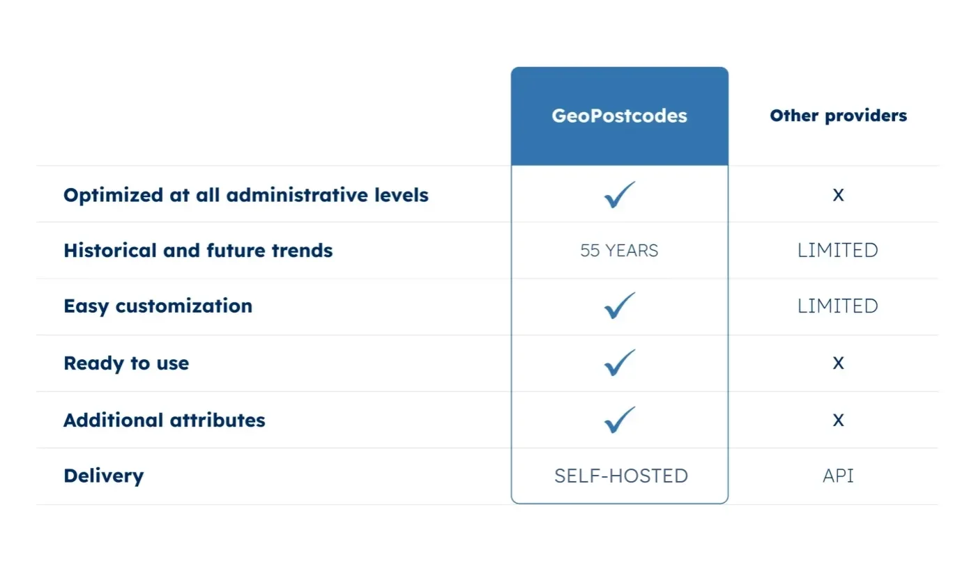
Seamless integration in your system
Our self-hosted database is standardized and pre-aggregated by zip code and administrative areas, making it ready to use in your visualization tools.

Rich attributes
Our population by zip code data can be enriched with country-specific information, time zones, multi-language, UNLOCODE, and IATA codes.
Unique expertise
Our team has 15 years of experience in Enterprise integration with an in-depth knowledge of each country's postal structure.
Reduce integration time by 30%

WHY GEOPOSTCODES
Use our data to increase quality, reduce costs
and free up internal resources
Use our data to increase quality, reduce costs and free up internal resources
Enterprise Grade Service
- Dedicated Customer Success Manager
- Self-hosted data
- Seamless integration in your system
- Standardized and unified data structure
Highest quality
- 55 year span
- Yearly updates
- Ready to use
- Precision at every level
Complete your geodataset
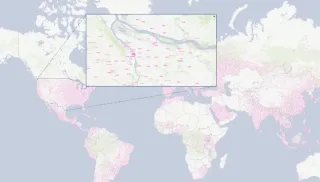
Zip code database
Global dataset containing all administrative divisions, cities and zip codes for 247 countries.
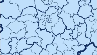
Boundary data
A global data set of polygons representing postal codes and administrative areas.
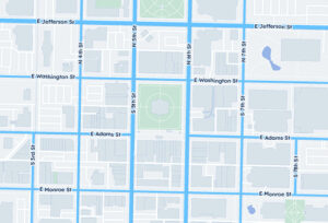
Address database
International data set with all administrative areas, localities, streets, and zip codes.
Frequently Asked Questions
The most populated zip code in the United States is 92154 located on the border with Mexico in San Diego, California.
In the United States, many zip codes have no population at all. Here are a few examples:
- 80294 – US District court of Colorado
- 20593 – National Air and Space Museum in Washington DC
The largest zip code in the world is 99950, which belongs to Ketchikan, Alaska, in the United States. This zip code covers a vast area, including remote and sparsely populated regions.
Refer to the following websites for accessing the latest international demographic and statistical data:
US Census Bureau: Delve into an array of population statistics and demographics for the United States, including age, race, ethnicity, and more. The Census Bureau offers comprehensive data for understanding population trends at national, state, and local levels.
Eurostat Database: Explore a wealth of demographic information for European Union countries through Eurostat’s extensive database. From population size and structure to migration and fertility rates, Eurostat provides insights into the diverse populations across Europe.
United Nations (UN) Population Download Center: Access global population data and indicators from the United Nations Population Division. Whether you’re researching population growth, urbanization trends, or demographic projections, the UN Population Download Center offers a wide range of datasets to support your analysis.
International Data (Population Reference Bureau): Gain a deeper understanding of international population dynamics with the Population Reference Bureau.
Their extensive database covers topics such as aging, family planning, and health, providing valuable insights for policymakers, researchers, and advocates worldwide.
GeoPostcodes combined diverse data sources to create a comprehensive population by zip code dataset for the past, present and future, updated and improved on a yearly basis.
The population by zip code refers to the number of people living in a specific area defined by zip codes. The Census Bureau provides detailed census data, which can be accessed online to find population information for any zip code. This data is stored in their databases and available in various forms.
The Census Bureau collects population data through surveys and the decennial census. This data is stored securely and made available in digital form for public access. The census data includes detailed information about the population by zip code, helping to identify the most populated zip codes in the country.
Some of the most populated zip codes are found in major cities across Florida, such as Miami and Orlando. According to census data, these areas have high population densities. The Census Bureau’s data helps in identifying these densely populated zip codes, which is useful for city planning and resource allocation.
Zip codes and postal codes are essential for the accurate and efficient delivery of mail. They help postal services sort and deliver mail to the correct locations. The population data by zip code assists in organizing delivery routes and ensuring timely mail delivery.
Cities in Florida use census data to understand their population distribution by zip code. This information helps in city planning, development, and resource allocation. The Census Bureau provides this data in an easily accessible form, which is crucial for making informed decisions about public services and infrastructure projects.
Some zip codes have no population because they might encompass areas like industrial zones, parks, or commercial regions without residential addresses. Additionally, certain zip codes are assigned for PO Boxes or administrative purposes, which do not house residents.