Worldwide Administrative
and ZIP Code Boundaries
Enterprise-ready boundary data with edge-matched polygons covering 247 countries.
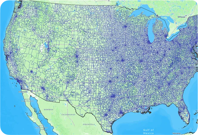
United States
boundary database

Global coverage
Extensive country coverage, including hard-to-source geographies like China, Japan, Brazil, and Russia.

Edge-matched polygons
Our proprietary topological model ensures shape accuracy. No gaps, no overlaps, no duplicate data.

High precision
Accurate mapping of the world at every level, up to 1-meter precision.
coverage
- Coherence and precision up to 6 levels
- Edge-matched polygons
- Clean coastlines and borders
- Proprietary topological model
- Geospatial expert consulting
| Country | Postal Codes | Regions | Cities | Admin Levels |
|---|---|---|---|---|
| United States | 41,353 | 3,197 | 53,436 | 2 |
| United Kingdom | 1,791,707 | 402 | 32,061 | 4 |
| Germany | 26,336 | 4,723 | 13,101 | 4 |
| France | 16,050 | 35,232 | 39,597 | 4 |
| Canada | 898,855 | 326 | 8,350 | 2 |
| Australia | 2,949 | 574 | 16,192 | 2 |
Use cases for boundary data
From shipping optimization to market analysis, our boundary data powers
key operations

Territory Mapping
Define and manage sales territories using accurate postal code and administrative boundaries.

Reporting and Business Intelligence
Ensure accurate and consistent reports across your organization. Enhance data analysis with location intelligence.

Geofencing
Define geofences that trigger alerts and
automate location-based campaigns with
meter-level accuracy.

Map and Visualization
Analyze complex trends and discover actionable insights. Build engaging and intuitive map-based data visualizations.

Network Design
Optimize shipping routes and design efficient logistics networks for operational excellence.

Risk Management
Map natural hazard risk areas to identify addresses at risk and minimize avoidable losses.
Trusted by industry leaders
Join more than 100 enterprise clients who trust GeoPostcodes for their location data
Anjo Grebe
Consultant

Dr. Peter Wild
Managing Partner

Kousha Mazloumi
Director of Data Science

Kousha Mazloumi
Director of Data Science

William Chao
Product Owner of Geographic Information Services

Kate Kilby
Senior Product Manager

Dave Hamm
Project Manager


Kavian Ranjbar
Data Governance Specialist

Nick Beaugié
Senior Software Engineer
Why choose GeoPostcodes

Global coverage
Complete coverage across 247 countries, including hard-to-source geographies like China, Japan, Brazil, and Russia.

Highest quality
Built on extensive, authoritative sourcing with robust data engineering and quality control. Standardized and up-to-date.

Expert Consulting
With 15 years of experience, we guide your implementation and deliver data in the format that fits your system.
GLOBAL COVERAGE
Most popular countries for boundary data
Explore our top countries for boundary data. You can also visit the country hubs to view all available countries.
Frequently Asked Questions
Admin-0 boundaries are the broadest and most fundamental administrative units in a geospatial data hierarchy. They define a country’s borders, marking its sovereignty’s limits.
Our boundary database ensures accuracy between polygons and between layers thanks to our topological model. All our data sets are updated frequently to ensure you get access to the most recent version of the geospatial data. Our outstanding quality comes from more than 10 years of double-checking and cross-referencing official sources.
Our boundary files come in 4 data sets formats (KML, GeoJSON, Shapefiles and Topojson). They can be easily integrated into your platform of choice. Our team will guide your integration process to ensure you get the most accurate spatial data analysis and map visualizations.
Our boundaries data is regularly updated by our data specialists to reflect the world’s changing geography. This ensures you always have the most current information for accurate planning and analysis.
Yes, our data is compatible with various GIS applications and can be overlaid on map tiles. This allows you to view detailed boundaries within your preferred mapping tools for enhanced visual representation.
We offer a public demo that lets you view sample data to evaluate its quality and compatibility with your needs. This gives you a firsthand look before committing.
We provide regular updates to account for any changes in boundaries. You’ll receive these updates regularly.