
KEY BENEFITS OF LEVERAGING GEOPOSTCODES DATA
- Reduced market analysis time and costs by 25%, enabling faster economic viability assessments across global markets
- Spot check establishment density measures against real population data for market analysis
- Streamline postal code-to-city mapping with primary localities data
OVERVIEW
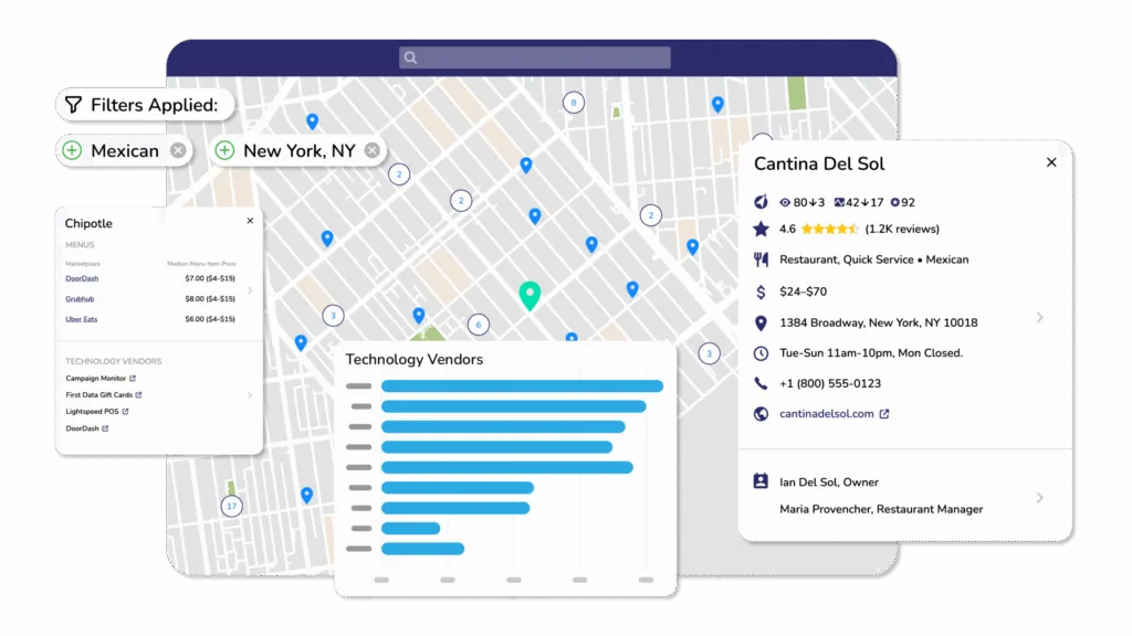
Brizo by Datassential equips foodservice leaders with trusted intelligence to act decisively and drive growth. Their market intelligence platform delivers rich, frequently updated data on over 2 million foodservice establishments across six countries, covering detailed operator attributes like menu items, technology adoption, cuisine type, and business details.
Backed by Datassential’s industry-leading expertise since their acquisition in May 2025, Brizo supports F&B manufacturers, distributors, and restaurant tech providers with sales prospecting, territory planning, marketing targeting, data enrichment, and competitive research.
We spoke with Kousha Mazloumi, Director of Data Science, to understand how GeoPostcodes’ population and postal data help them analyze restaurant industry trends and assess economic viability across different markets.
CHALLENGE
Can you explain how Brizo analyzes restaurant industry trends?
KOUSHA: Our platform covers over 2 million foodservice establishments, and the data is refreshed every 30 days. We know when a restaurant opens or closes in an area.
This gives us a good view of what’s happening at any moment in a specific state or city, which regions are seeing an increased establishment count, and which ones are on the way down.
What challenges did you face when analyzing this data?
KOUSHA: That data is sometimes slanted by seasonality noise. For example, at the end of summer, you might have a lot of businesses closing down for the rest of the season, and vice versa with winter-focused operators.
In other cases, areas have so few businesses that it becomes difficult to draw any meaningful conclusions. For example, if you have four restaurants located in a postal code, and one of them closes, that’s 25% down.
Alarm bells would then go off, stating that the postal code is destructive for business. In reality, looking at the larger context, this is just a very small postal code; thus, the loss is not that bad.
What was your approach to mapping postal codes to cities before GeoPostcodes?
KOUSHA: To map each postal code to a city, we would measure the portion of the city that falls into each postal code. Then we would assign the postal code to the bigger portion. This was obviously difficult to keep track of.
SOLUTION
How did GeoPostcodes data help you link cities to postal codes?
KOUSHA: This Primary cities file is very useful in that aspect. Postal codes are sometimes linked to several cities. The dataset helps to clarify the relationship between them to make decisions across countries more easily.
The concept of the city will receive different names or belong to different hierarchical levels depending on the country. And then you also have the problem when a postal code is split between two different cities.
When we switched to GeoPostcodes, it was convenient to have access to the Primary cities database because it was aligned with our customers’ expectations, saving us computation time.
How does GeoPostcodes' population data help address these challenges?
KOUSHA: Adding GeoPostcodes population data becomes a proxy to justify longer-term changes. For example, this month, a specific postal code is doing well on openings vs. closings.
On the other hand, the population data shows that over the next X years, the population will drop. Now we know we can downgrade the postal code in terms of economic viability.
How do you use the data for site selection?
KOUSHA: We spot check our customers’ establishment presence per area with real population data. For example, if a chain would like to open a new restaurant in X city, we can calculate the differential between the establishment density and the population density to understand if that area is underserved or overserved.
Doing so, we may find out the area has a low population density but a high establishment density. Based on this information, our customers may decide not to open the new restaurant here.
Can you explain how you estimate economic viability?
What has been your experience working with the GeoPostcodes team?
KOUSHA: The main highlight was having all the data in one place and getting access to the Data Explorer, a tool to navigate and download the data easily. Thanks to working with GeoPostcodes, we reduced the time and cost of data analysis by 25%.
In my experience working with the team at GeoPostcodes, I found that they were always very willing to listen to my concerns and come back with proposed solutions. It was nice to get someone to help me make the best use of the data. Every person I have interacted with is very friendly and positive.
CONCLUSION
By integrating GeoPostcodes’ population and postal data, Brizo by Datassential has transformed how they analyze restaurant industry trends and help industry-leading foodservice companies assess their largest market opportunities.
The combination of Brizo’s restaurant opening/closing data with GeoPostcodes’ population trends provides a comprehensive view of economic viability, helping clients make informed decisions about the restaurant landscape and market expansion.
With access to standardized postal codes and primary cities data across the US, Canada, UK, New Zealand, and Australia, Brizo can deliver more accurate insights while reducing computation time and complexity.
For a company operating in the fast-paced foodservice industry, having reliable population data is essential for spotting genuine market trends versus seasonal noise and identifying underserved or oversaturated markets.
Discover how GeoPostcodes can support your market analysis and business intelligence needs. Browse our databases for free or request a quote here.

Population database
Global population estimates at zip code and administrative level covering a span of 55 years: past, present, and future.

ZIP code database
Global data set containing all administrative divisions, cities and zip codes for 247 countries.
