
Key takeaways
- International geocoding converts physical addresses worldwide into precise geographic coordinates.
- Powers critical business functions: logistics optimization, market research, targeted advertising, and last-mile delivery operations.
- Mid resolution geocoding (postal code level) works effectively for most business applications.
- International geocoding faces unique challenges with varied address formats and languages.
What is International Geocoding?
Ever wondered how your GPS finds a tiny restaurant in Tokyo or how delivery services hit the correct address across continents? The secret is geocoding.
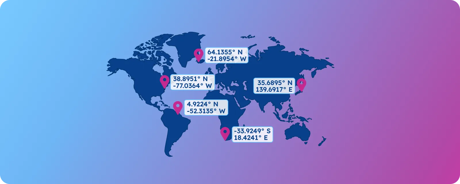
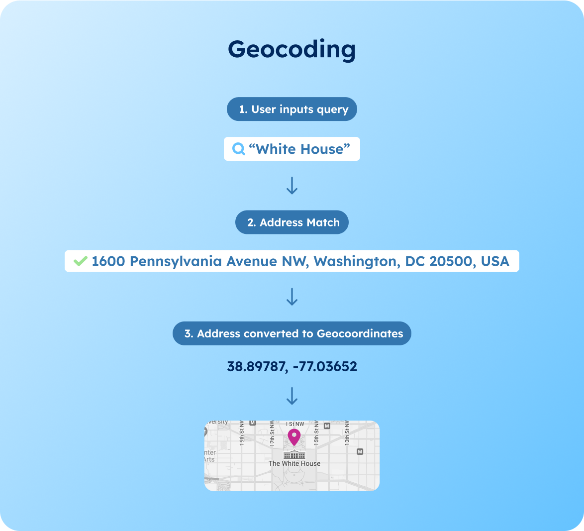
What is international geocoding? It is the process of converting physical addresses into geographic coordinates (latitude and longitude). This process enables businesses to transform addresses like “Rue de la Loi 1, 1000 Bruxelles” into precise map coordinates.
While high-resolution geocoding (house number-level) exists, many business applications effectively operate with low-resolution geocoding (city or country-level) to mid-resolution geocoding (postal code or street-level). This flexibility in precision levels makes geocoding both versatile and cost-effective for various business needs.
As businesses continue to expand globally, this technology powers crucial business functions, including logistics optimization, market research, targeted advertising, and last-mile delivery services worldwide.
💡 Simplify your international geocoding challenges with comprehensive global location data. GeoPostcodes provides high-accuracy geocoding up to the postal code-level across 247 countries. Our coordinates enable distance calculation, map visualization and radius search at global scale. Browse our international datasets and download a free sample here.
Functions of Geocoding
To fully understand how geocoding can benefit your business, let’s explore the three primary functions that make it invaluable for modern businesses:
- Map Visualization: Converting addresses to display precise locations on digital maps
- Distance Calculation: Enabling computation of distances between different geographic points
- Radius Search: Finding all locations, customers, or services within a specific distance from a given point for proximity-based queries
- Ad Targeting: Delivering location-specific advertisements and promotional content based on precise geographic coordinates
- Address Capture: Validating and standardizing address inputs in real-time to ensure data quality and delivery accuracy
With these core functions in mind, let’s look at how you can implement geocoding in your business operations.
Business Applications
Now that we understand the basic functions, let’s explore how international geocoding powers several critical business solutions:
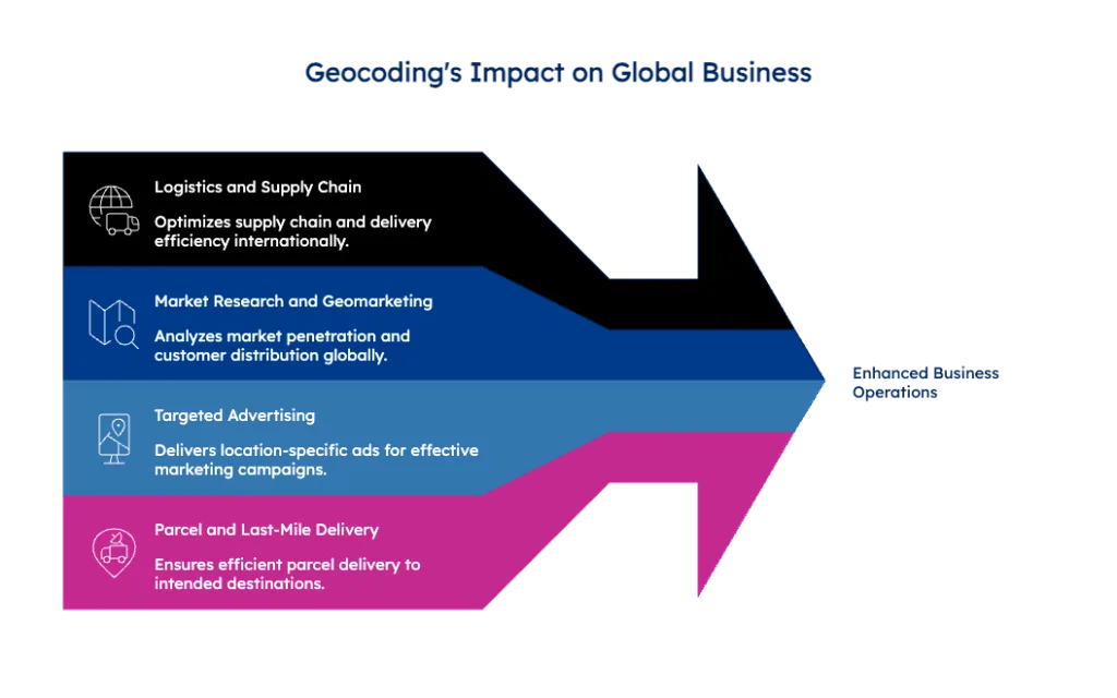
Logistics and Supply Chain Management
Companies use geocoding to optimize their supply chain operations, track shipments, and improve delivery efficiency across international borders. This foundation of location intelligence enables smoother global operations.
Market Research
Building on location data, businesses leverage geocoding to analyze market penetration, understand customer distribution, and make data-driven decisions about market expansion. This insight is particularly valuable for international growth strategies.
Targeted Advertising
With precise location data in hand, geocoding enables companies to deliver location-specific advertisements and promotional content to their target audience, creating more relevant and effective marketing campaigns.
Parcel and Last-Mile Delivery
At the most practical level, delivery services rely on accurate geocoding to ensure packages reach their intended destinations efficiently, completing the crucial last step in the logistics chain.
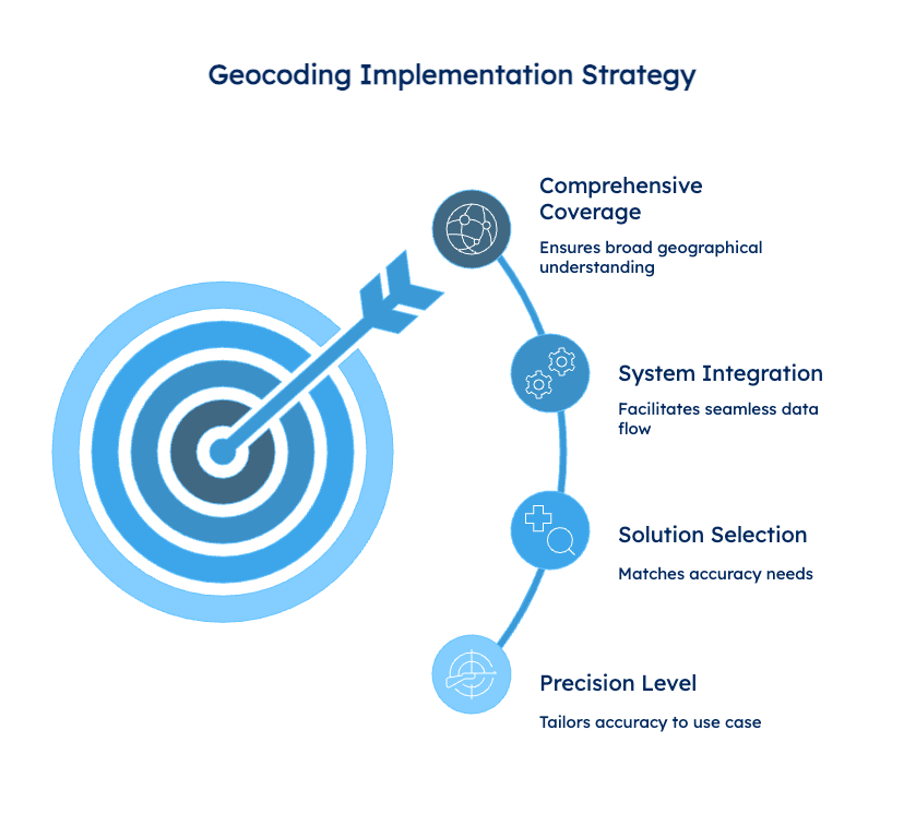
Practical Implementation
Having explored the applications and resolution levels, here are the key steps to implement geocoding effectively. Businesses should:
- Determine the required level of geocoding precision for their specific use case – consider both street-level and postal code databases for comprehensive coverage.
- Choose appropriate geocoding solutions that match their accuracy requirements
- Ensure their systems can properly integrate with geocoding data
💡 Ready to implement geocoding? GeoPostcodes offers pre-built datasets covering 247 countries that integrate directly into your systems without complex API setups. Our geocoding solutions provide flexible precision levels from postal code to street-level accuracy, making implementation straightforward and cost-effective for any business requirement.
Challenges for International Geocoding vs Same-Country Geocoding
International geocoding has to deal with a wide range of address formats and languages that vary from one country to another. It needs to support non-Latin characters, transliteration, and region-specific logic, which most solutions aren’t built to handle.
As a result, accurate global geocoding plays a crucial role in enabling cross-border logistics, supply chains, and international growth.
Conclusion
Throughout this guide, we’ve explored how geocoding transforms physical addresses into actionable geographic coordinates, enabling everything from efficient logistics to targeted marketing.
Whether you need high-precision mapping or postal-code-level accuracy, the right geocoding solution can dramatically improve your business operations.
The key to successful implementation lies in choosing the right solution for your specific needs, considering factors like resolution requirements, data quality, and integration capabilities.
Remember that while high-resolution geocoding is available, many business applications can achieve results with lower resolution.
Ready to enhance your business with reliable geocoding data? GeoPostcodes offers comprehensive international datasets covering 247 countries with weekly updates that you can directly integrate into your IT infrastructure. No complex API setups or third-party dependencies are required.
We invite you to browse our databases for free or request a quote to experience the difference quality geocoding data can make for your business.
FAQ
What is meant by geocoding?
Geocoding converts any address, street, ZIP code, city, administrative area, or UNLOCODE into latitude and longitude coordinates. Reverse geocoding does the opposite, for instance it gets an address from latitude and longitude coordinates.
What is the best geocoding service?
The best geocoding service depends on your needs for forward geocoding, reverse geocoding and batch geocoding capabilities.
Look for providers offering sample codes, accurate geocoding results for single addresses or many addresses, comprehensive zip code coverage, and reliable spatial analysis features for informed decisions.
What is geocode in the USA?
In the USA, geocoding transforms addresses entered into latitude and longitude geographic coordinates using zip codes and street addresses.
This enables mapping applications to perform spatial analysis, locate the nearest street address, handle time zones, and support both single address and batch geocoding for customer data analysis.
How to verify geocoding accuracy for location-based services?
Businesses verify accuracy by implementing validation processes that check input addresses and resulting coordinates across international formats.
Verification should validate street names, administrative areas, and country data, testing precision from postal code to rooftop level to ensure reliable results for market analysis and location-based applications.