

Territory Mapping
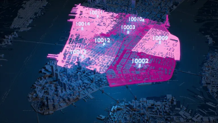
Define and manage sales territories using accurate postal code and administrative boundaries.
Download high-quality, up-to-date shapefile boundaries (SHP, projection system SRID 4326).






Empower your location based operations, applications and map visualizations with our edge matched polygons
| Country | Postal Codes | Regions | Cities | Admin Levels |
|---|---|---|---|---|
| United States | 41,353 | 3,197 | 53,436 | 2 |
| United Kingdom | 1,791,707 | 402 | 32,061 | 4 |
| Germany | 26,336 | 4,723 | 13,101 | 4 |
| France | 16,050 | 35,232 | 39,597 | 4 |
| Canada | 898,855 | 326 | 8,350 | 2 |
| Australia | 2,949 | 574 | 16,192 | 2 |
From shipping optimization to market analysis, our boundary data powers key operations
Territory Mapping
Define and manage sales territories using accurate postal code and administrative boundaries.

Reporting and Business Intelligence
Ensure accurate and consistent reports across your organization. Enhance data analysis with location intelligence.

Geofencing
Define geofences that trigger alerts and automate location-based campaigns with meter-level accuracy.

Map and Visualization
Analyze complex trends and discover actionable insights. Build engaging and intuitive map-based data visualizations.

Network Design
Optimize shipping routes and design efficient logistics networks for operational excellence.

Risk Management
Map natural hazard risk areas to identify addresses at risk and minimize avoidable losses.
 Global coverageExtensive country coverage, including hard-to-source geographies like China, Japan, Brazil, and Russia.
 Edge-matched polygonsOur proprietary topological model ensures shape accuracy. No gaps, no overlaps, no duplicate data.
 High precisionAccurate mapping of the world at every level, up to 1-meter precision.
Join more than 100 enterprise clients who trust GeoPostcodes for their location data

“GeoPostcodes' global ZIP codes allow us to determine distances accurately. Thanks to their up-to-date database, we no longer have problems with missing locations, making our system much more efficient and reliable.”


“The concept of the city receives different names or belongs to different hierarchical levels depending on the country. Using GeoPostcodes' data gave us access to city definitions aligned with our customers' expectations, saving us computation time.”


“GeoPostcodes' multi-level boundaries were perfectly aligned, enabling seamless integration with multiple secure cloud platforms. Our software can now provide more accurate visualizations for risk analysis and natural hazard monitoring.”


“GeoPostcodes databases provide IATA codes, enhanced UNLOCODEs with port terminal data, addresses, and more – all on a global scale! This level of accuracy is essential for our mileage and CO2 emissions calculation.”


“The world is constantly changing. New localities and neighborhoods open up or become dispersed. It's good to know that GeoPostcodes is keeping on top of those changes and providing us with updated information to work with.”


“Countries like Brazil or China are particularly strict with their customs validation. GeoPostcodes' ZIP codes and Enhanced UNLOCODES database are aligned with national regulations, ensuring seamless transportation and compliance.”

“GeoPostcodes' Population data shows population forecasts over the next years. We can use it as a proxy to justify longer-term changes and downgrade postal code areas in terms of economic viability.”


“The key aspect of working with GeoPostcodes has been their ability to provide customized data solutions. Their collaborative approach has made them an excellent partner in addressing our location data challenges.”


“If you've got a business where locations are a big part of it and you're looking to avoid the large costs that can be involved in using APIs, GeoPostcodes' on-premise database is definitely worth considering.”

Global coverage
Complete coverage across 247 countries, including hard-to-source geographies like China, Japan, Brazil, and Russia.
Highest quality
Built on extensive, authoritative sourcing with robust data engineering and quality control. Standardized and up-to-date.
Expert Consulting
With 15 years of experience, we guide your implementation and deliver data in the format that fits your system.
Explore our comprehensive collection of Malaysia ZIP code and administrative data products, designed to meet all your mapping and location intelligence needs.
Malaysia uses a "Postal code" system, which is a five-digit numeric format, like 99999, with no letters or separators. This means it uses only numbers. According to the GeoPostcodes world postal code database, Malaysia has 2,744 postal codes covering 203 regions and 484 towns. This format is similar to numeric US ZIP codes as both are five digits long and purely numeric.
The database follows a standardized and unified structure you can integrate without becoming an expert in each country’s unique administrative hierarchy.
Key Features:
Address conventions differ by country, leading to frequent validation errors and incomplete entries. Our dataset applies Malaysia correct address format to ensure clean inputs, smoother validation, and reduced delivery mistakes.
GeoPostcodes offers reliable reference data to validate Malaysia addresses. Our database ensures addresses follow the correct format for Malaysia, reducing delivery errors and improving efficiency.
Comprehensive location data products serving businesses, and organizations worldwide with accurate, up-to-date geographic information.
Global dataset containing all administrative divisions, cities and ZIP codes.
Explore postal code database
International dataset with all administrative areas, cities, ZIP codes, streets, and house numbers.
Explore address database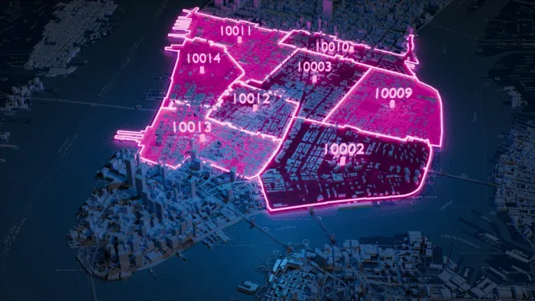
A global dataset of polygons representing ZIP codes and administrative areas.
Explore boundaries database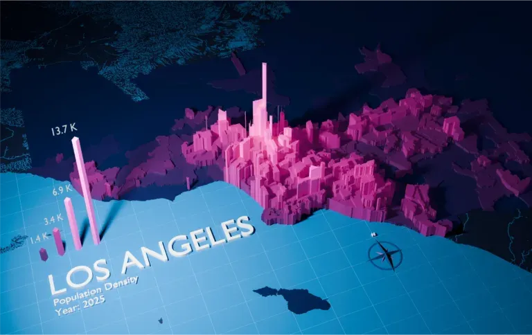
Global population estimates at postal code and administrative level covering a span of 55 years: past, present, and future.
Explore population database247 countries and territories with standardized formatting and reliable geographic information.
 AfghanistanBoundary data
 BangladeshBoundary data
 BruneiBoundary data
 BhutanBoundary data
 ChinaBoundary data
 Hong KongBoundary data
 IndonesiaBoundary data
 IndiaBoundary data
 JapanBoundary data
 KyrgyzstanBoundary data
 CambodiaBoundary data
 North KoreaBoundary data
 South KoreaBoundary data
 KazakhstanBoundary data
 LaosBoundary data
 Sri LankaBoundary data
 Myanmar (Burma)Boundary data
 MongoliaBoundary data
Admin-0 boundaries are the broadest and most fundamental administrative units in a geospatial data hierarchy. They define a country's borders, marking its sovereignty's limits.
Our boundary database ensures accuracy between polygons and between layers thanks to our topological model. All our data sets are updated frequently to ensure you get access to the most recent version of the geospatial data. Our outstanding quality comes from more than 10 years of double-checking and cross-referencing official sources.
Our boundary files come in 4 data sets formats (KML, GeoJSON, Shapefiles and Topojson). They can be easily integrated into your platform of choice. Our team will guide your integration process to ensure you get the most accurate spatial data analysis and map visualizations.
Our boundaries data is updated weekly to reflect any changes in postal codes or geographical areas. This ensures you always have the most current information for accurate planning and analysis.
Yes, our data is compatible with various GIS applications and can be overlaid on map tiles. This allows you to view detailed boundaries within your preferred mapping tools for enhanced visual representation.
We offer a public demo that lets you view sample data to evaluate its quality and compatibility with your needs. This gives you a firsthand look before committing.
We provide regular updates to account for any changes in boundaries. You'll receive these updates regularly.
Updated: October 1, 2026