

















Panama Administrative Divisions

What is the hierarchy of administrative divisions in Panama?

Panama operates on a 3‑level system starting with 16 provinces, then districts, and subdivisions as the smallest administrative units.

Here’s a breakdown of the hierarchy:

1. Provinces: Panama is divided into 16 provinces.

2. Districts: Provinces are subdivided into districts.

3. Subdivisions: These are the smallest administrative units, often found within districts.

List of Panama's administrative divisions with their counts and names

These are the summarized administrative divisions. The full dataset is available in the Download Center.

isocountryadmin level 1admin level 2admin level 3admin level 4
PAPanamaBocas del Toro (Province)4 Districts40 SubdivisionsThis level doesn’t exist for this country.
PAPanamaChiriqui (Province)14 Districts105 SubdivisionsThis level doesn’t exist for this country.
PAPanamaCocle (Province)6 Districts47 SubdivisionsThis level doesn’t exist for this country.
PAPanamaColon (Province)6 Districts43 SubdivisionsThis level doesn’t exist for this country.
PAPanamaDarien (Province)3 Districts26 SubdivisionsThis level doesn’t exist for this country.
PAPanamaEmbera-Wounaan (Indigenous territory)2 Districts5 SubdivisionsThis level doesn’t exist for this country.
PAPanamaGuna de Madungandi (Indigenous territory)This level doesn’t exist for this country.This level doesn’t exist for this country.This level doesn’t exist for this country.
PAPanamaGuna de Wargandi (Indigenous territory)This level doesn’t exist for this country.This level doesn’t exist for this country.This level doesn’t exist for this country.
PAPanamaGuna Yala (Indigenous territory)1 District4 SubdivisionsThis level doesn’t exist for this country.
PAPanamaHerrera (Province)7 Districts49 SubdivisionsThis level doesn’t exist for this country.
PAPanamaLos Santos (Province)7 Districts81 SubdivisionsThis level doesn’t exist for this country.
PAPanamaNaso Tjer Di (Indigenous territory)1 District1 SubdivisionThis level doesn’t exist for this country.
PAPanamaNgabe-Bugle (Indigenous territory)9 Districts72 SubdivisionsThis level doesn’t exist for this country.
PAPanamaPanama Oeste (Province)5 Districts59 SubdivisionsThis level doesn’t exist for this country.
PAPanamaPanama (Province)6 Districts57 SubdivisionsThis level doesn’t exist for this country.
PAPanamaVeraguas (Province)12 Districts105 SubdivisionsThis level doesn’t exist for this country.

Why is building an Administrative Divisions Database complex?

The complexity arises from inconsistent global standards, frequent boundary changes, non-uniform naming conventions (e.g., “suburb” in Australia vs. “county” in the US), and variations in administrative levels across countries. Integrating and harmonizing data from multiple sources requires advanced normalization, versioning, and geospatial validation techniques.

How does GeoPostcodes solve the problem for you?

Our standardized database overcomes the complexity of different administrative division
systems worldwide. Our database follows a unified structure that you can integrate
seamlessly into your system or platform of choice without needing to become an expert in
each country’s unique administrative hierarchy.

Download the complete Dataset

Explore the comprehensive list of administrative divisions, standardized and scalable across 247 countries.

Why choose GeoPostcodes

Global coverage

Complete coverage across 247 countries, including hard-to-source geographies like China, Japan, Brazil, and Russia.

Highest quality

Built on extensive, authoritative sourcing with robust data engineering and quality control. Standardized and up-to-date.

Expert Consulting

With 15 years of experience, we guide your implementation and deliver data in the format that fits your system.

Trusted by industry leaders

Join more than 100 enterprise clients who trust GeoPostcodes for their location data

GeoPostcodes - Ecotransit logo
“GeoPostcodes’ global ZIP codes allow us to determine distances accurately. Thanks to their up-to-date database, we no longer have problems with missing locations, making our system much more efficient and reliable.”

Anjo Grebe

Consultant

“GeoPostcodes databases provide IATA codes, enhanced UNLOCODEs with port terminal data, addresses, and more – all on a global scale! This level of accuracy is essential for our mileage and CO2 emissions calculation.”
GeoPostcodes - Peter Wild CarbonCare

Dr. Peter Wild

Managing Partner

“GeoPostcodes’ Population data shows population forecasts over the next years. We can use it as a proxy to justify longer-term changes and downgrade postal code areas in terms of economic viability.”

Kousha Mazloumi

Director of Data Science

“The concept of the city receives different names or belongs to different hierarchical levels depending on the country. Using GeoPostcodes’ data gave us access to city definitions aligned with our customers’ expectations, saving us computation time.”

Kousha Mazloumi

Director of Data Science

GeoPostcodes - Logo_DB_Schenker
“The world is constantly changing. New localities and neighborhoods open up or become dispersed. It’s good to know that GeoPostcodes is keeping on top of those changes and providing us with updated information to work with.”
GeoPostcodes-GeoPostcodes-William chao picture

William Chao

Product Owner of Geographic Information Services

GeoPostcodes - Bark Logo
“The key aspect of working with GeoPostcodes has been their ability to provide customized data solutions. Their collaborative approach has made them an excellent partner in addressing our location data challenges.”

Kate Kilby

Senior Product Manager

GeoPostcodes - Opterrix-logo
“GeoPostcodes’ multi-level boundaries were perfectly aligned, enabling seamless integration with multiple secure cloud platforms. Our software can now provide more accurate visualizations for risk analysis and natural hazard monitoring.”

Dave Hamm

Project Manager

“Countries like Brazil or China are particularly strict with their customs validation. GeoPostcodes’ ZIP codes and Enhanced UNLOCODES database are aligned with national regulations, ensuring seamless transportation and compliance.”
GeoPostcodes - Kavian Ranjbar

Kavian Ranjbar

Data Governance Specialist

“If you’ve got a business where locations are a big part of it and you’re looking to avoid the large costs that can be involved in using APIs, GeoPostcodes’ on-premise database is definitely worth considering.”
GeoPostcodes-Nick Baugie

Nick Beaugié

Senior Software Engineer

Our location dataset for Panama

Explore our comprehensive collection of Panama ZIP code and administrative data products, designed to meet all your mapping and location intelligence needs.

Panama ZIP Codes

ZIP code systems vary across countries, and Panama follows its own format. The ZIP code database captures the official structure -covering the correct ZIP code pattern, associated cities and administrative levels, and any regional or hierarchical relationships—and standardizes it all into a unified global schema.

Panama ZIP & Administrative boundaries

Panama administrative landscape often follows inconsistent regional models and irregular public sources, making it difficult to maintain reliable boundaries. Our standardized postal and administrative boundary data resolves these gaps to ensure complete, coherent geographic coverage.

Panama Address Format

Address conventions differ by country, leading to frequent validation errors and incomplete entries. Our dataset applies Panama correct address format to ensure clean inputs, smoother validation, and reduced delivery mistakes.

Address validation - Panama address validation

Comprehensive Panama ZIP code, city, and address data to verify and correct existing addresses at input, post-entry, or in bulk.

Global Location Databases

Comprehensive location data products serving businesses, and
organizations worldwide with accurate, up-to-date geographic information.

Postal code samples

Postal Code Database

Global dataset containing all administrative divisions, cities and ZIP codes.

Explore postal code database

Key features

  • 247 Countries
  • 9,9M Coordinates
  • 9,3M ZIP codes
  • 400 Time zones
  • 4M Cities and Towns
  • 116K UNLOCODES

Specifications

  • Coverage: Global
  • Format: CSV, ASC, DAT, GML, GeoJSON, KML, Shapefile (SHP)

Street address dataset

Address Database

International dataset with all administrative areas, cities, ZIP codes, streets, and house numbers.

Explore address database

Key features

  • 81 Countries
  • 299 languages
  • 26,5M streets
  • 400 time zones
  • 9.3M ZIP codes
  • 4M cities

Specifications

  • Coverage: International
  • Format: CSV, ASC, DAT, GML, KML, Shapefile (SHP), GeoJSON
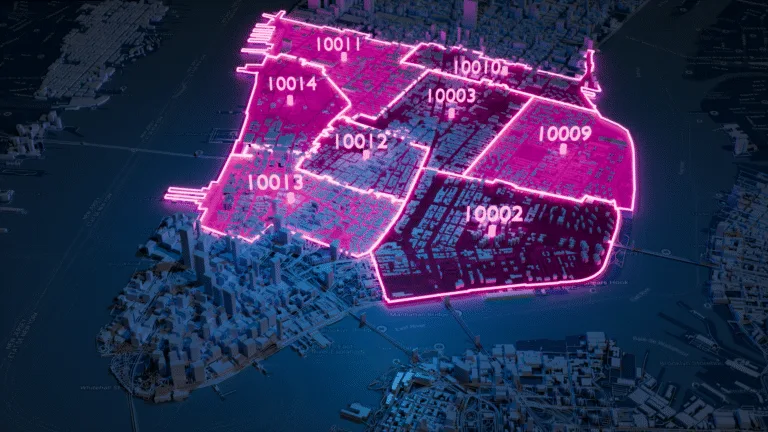
Boundary polygons

Boundary Data

A global dataset of polygons representing ZIP codes and administrative areas.

Explore boundaries database

Key features

  • 247 Countries
  • Up to 6 levels
  • 1,7M boundaries
  • High-precision
  • 245K Admin areas
  • Visualization

Specifications

  • Coverage: Global
  • Format: GeoJSON, Geopackage, KML, Shapefile (SHP)
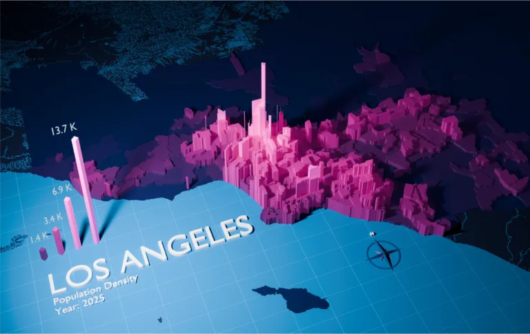
Los Angeles population map

Population Database

Global population estimates at postal code and administrative level covering a span of 55 years: past, present, and future.

Explore population database

Key features

  • 247 Countries
  • 243K Admin areas
  • 55 year span
  • Yearly updates
  • 645K ZIP codes

Specifications

  • Coverage: International
  • Format: CSV, ASC
Updated: July 1, 2026

Frequently Asked Questions

Panama is divided into 10 provinces (Provincias) and 6 indigenous territories (Comarcas indígenas), which form the top-level administrative units. These are subdivided into 77 districts (Distritos). The smallest administrative level consists of 631 subdivisions (Corregimientos). Major provinces include Bocas del Toro, Chiriqui, and Cocle.

Panama has 3 administrative levels. Level 1: 10 provinces (Provincias) and 6 indigenous territories (Comarcas indígenas). Level 2: 77 districts (Distritos). Level 3: 631 subdivisions (Corregimientos).

Panama operates on a 3‑level system starting with 16 provinces, then districts, and subdivisions as the smallest administrative units. Note that Guna de Madungandi, Guna de Wargandi do not have sub-divisions at the next level.

In Panama, provinces and indigenous territories both sit at administrative level 1 but serve different functions. Provinces (provincias) — there are 10 — typically group multiple smaller municipalities under a shared administration. Indigenous territories (comarcas indígenas) — there are 6 — are a larger city or urban area that handle its own administration independently.

Panamanian administrative divisions have specific local names at each level. In Spanish, provinces are called Provincias; indigenous territories are called Comarcas indígenas; districts are called Distritos; subdivisions are called Corregimientos. These local-language terms appear in official documents, legal records, and government databases, so matching them correctly is important for data integration and compliance.

Administrative boundaries in Panama change as governments reorganize regions, merge municipalities, or create new administrative units to reflect population shifts and political decisions. Changes most commonly affect the subdivisions level, where Panama currently has 631 units. Businesses that rely on Panamanian administrative data should use a regularly updated reference dataset to avoid mismatches in geocoding, tax jurisdiction mapping, and compliance reporting.