World Postal Code > Boundaries database > North America Shapefiles > United States Shapefiles
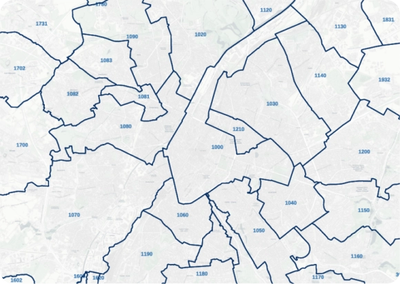
United States Shapefiles: States, Counties & Zip codes
Download high-quality, up-to-date shapefile boundaries (SHP, projection system SRID 4326).
TRUSTED BY THE INDUSTRY LEADERS
Power your product with our high‑quality polygons
- Available formats: Shapefile, GeoJSON, KML, ASC, DAT, CSV, and GML formats
- Marketplace integration: Esri, Datarade, SAP, DataBricks, Google Cloud
- Host your data in the cloud
- Integrate within your software of choice
- Fixed yearly pricing
- License tailored to your scope
- Dedicated onboarding included
- Integration within your product allowed

PRODUCT HIGHLIGHTS

Postal and Administrative Areas for 247 Countries
Coherence and precision at every level
Edge-matched polygons
Our proprietary data-mastering processes guarantee shape accuracy, featuring a topological model and a dedicated algorithm to establish spatial relationships.
- No gaps or overlaps
- No duplicate data thanks to mutualized edges
- Clean coastlines and borders
WHY GEOPOSTCODES
High-quality administrative boundaries and unique expertise
Highest quality
- Edge-matched polygons
- Precision at every level
- Proprietary topological model
Unique expertise
- Fast and agile implementation
- Dedicated GIS Expert
- 100+ successful integrations
World coverage
- 247 countries
- Difficult geographies
- Up to 6 levels

Rich attributes
Our administrative boundaries data can be enriched with country-specific information, population, multi-language support, UNLOCODE, IATA codes, and time zones.
High-precision for spatial analysis
Our high-resolution shapes are put together with up to 1-meter precision, making it perfect for in-depth spatial analysis, clustering, geofencing, and reverse geocoding.
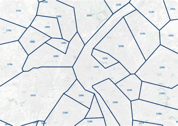
Fast-loading for reporting and BI
Get our lightweight, simplified, yet exhaustive format for a fast rendering. Our proprietary algorithm ensures all entities remain visible and perfectly connected after simplification.

“Having postal boundary visualization works much better for customers than putting things in a table.”
William Chao
Product Owner, Geographic Information Services

“GeoPostcodes allows us to confidently and accurately map zip codes to natural hazard event boundaries”
Dave Hamm
Project Manager
Get a custom pricing tailored to your needs
Interested in the full database? Ask for a quote.
Our pricing model depends on a few factors such as products, features, use case and country coverage.
Get in touch to receive an accurate pricing proposal.
Annual licenses are priced based on the number of countries needed, type of usage, products and the features (additional datasets).
Our licenses have a fixed price and include everything: comprehensive location data, unlimited updates, the right to employ it for your use case, and continuous support from a dedicated expert.
Data is updated weekly, but you can decide on your own update frequency depending on your use case. You can get automatic differential updates and a list of historical ID changes by using our download API.