Worldwide Address Database
A comprehensive database of street names, coordinates, and address ranges for Enterprise


Comprehensive address data for 247 countries
| ISO | Country | Postal Codes | Coordinates | Streets | Languages | Admin levels | Time zones |
|---|---|---|---|---|---|---|---|
| AMERICA | |||||||
| CA | Canada | ✔ | ✔ | ✔ | 2 | 1 | 1 |
| GL | Greenland | ✔ | ✔ | ✔ | 1 | 2 | 1 |
| MX | Mexico | ✔ | ✔ | ✔ | 1 | 2 | 1 |
| US | United States | ✔ | ✔ | ✔ | 1 | 1 | 1 |
| AG | Antigua & Barbuda | ✔ | 1 | 1 | 1 | ||
| AI | Anguilla | ✔ | ✔ | 2 | 3 | 1 | |
| AR | Argentina | ✔ | ✔ | ✔ | 2 | 3 | 1 |
| AW | Aruba | ✔ | 2 | 3 | 1 | ||
| BB | Barbados | ✔ | ✔ | 2 | 3 | 1 | |
| BL | Saint Barthélemy | ✔ | ✔ | ✔ | 1 | 2 | 1 |
| BM | Bermuda | ✔ | ✔ | ✔ | 2 | 3 | 1 |
| BO | Bolivia | ✔ | 1 | 3 | 9 | ||
| BR | Brazil | ✔ | ✔ | ✔ | 1 | 1 | 1 |
| BS | Bahamas | ✔ | 3 | 3 | 1 | ||
| BZ | Belize | ✔ | 2 | 2 | 1 | ||
| CL | Chile | ✔ | ✔ | ✔ | 2 | 3 | 1 |
| CO | Colombia | ✔ | ✔ | ✔ | 1 | 1 | 1 |
| CR | Costa Rica | ✔ | ✔ | 1 | 3 | 1 | |
| CU | Cuba | ✔ | ✔ | 3 | 4 | 1 | |
| CW | Curaçao | ✔ | 2 | 3 | 1 | ||
| DM | Dominica | ✔ | 2 | 3 | 1 | ||
| DO | Dominican Republic | ✔ | ✔ | 1 | 1 | 1 | |
| EC | Ecuador | ✔ | ✔ | ✔ | 2 | 3 | 1 |
| FK | Falkland Islands | ✔ | ✔ | 2 | 2 | 1 | |
| GD | Grenada | ✔ | 2 | 0 | 1 | ||
| GF | French Guiana | ✔ | ✔ | ✔ | 1 | 1 | 1 |
| GP | Guadeloupe | ✔ | ✔ | ✔ | 1 | 2 | 1 |
| GT | Guatemala | ✔ | ✔ | 2 | 3 | 1 | |
| GY | Guyana | ✔ | 2 | 3 | 3 | ||
| HN | Honduras | ✔ | ✔ | 1 | 1 | 1 | |
| HT | Haiti | ✔ | ✔ | 1 | 2 | 1 | |
| JM | Jamaica | ✔ | 2 | 0 | 1 | ||
| KN | Saint Kitts and Nevis | ✔ | ✔ | 1 | 2 | 1 | |
| KY | Cayman Islands | ✔ | ✔ | 2 | 3 | 1 | |
| LC | Saint Lucia | ✔ | ✔ | 1 | 1 | 1 | |
| MF | Saint Martin | ✔ | ✔ | ✔ | 2 | 3 | 10 |
| MQ | Martinique | ✔ | ✔ | ✔ | 1 | 0 | 1 |
| MS | Montserrat | ✔ | ✔ | 2 | 3 | 2 | |
| NI | Nicaragua | ✔ | ✔ | 2 | 3 | 1 | |
| PA | Panama | ✔ | ✔ | 1 | 2 | 1 | |
| PE | Peru | ✔ | ✔ | 4 | 3 | 1 | |
| PM | Saint Pierre & Miquelon | ✔ | ✔ | ✔ | 2 | 4 | 1 |
| PR | Puerto Rico | ✔ | ✔ | ✔ | 1 | 1 | 1 |
| PY | Paraguay | ✔ | ✔ | 2 | 3 | 3 | |
| SR | Suriname | ✔ | 2 | 3 | 1 | ||
| SV | El Salvador | ✔ | ✔ | 2 | 4 | 3 | |
| SX | Sint Maarten | ✔ | ✔ | 2 | 4 | 1 | |
| TC | Turks and Caicos Islands | ✔ | ✔ | 2 | 3 | 1 | |
| TT | Trinidad & Tobago | ✔ | 2 | 2 | 1 | ||
| UY | Uruguay | ✔ | ✔ | ✔ | 2 | 2 | 1 |
| VC | St Vinc. & Grenadines | ✔ | ✔ | 1 | 0 | 1 | |
| VE | Venezuela | ✔ | ✔ | 1 | 0 | 1 | |
| VG | British Virgin Islands | ✔ | ✔ | 2 | 1 | 1 | |
| VI | U.S. Virgin Islands | ✔ | ✔ | ✔ | 2 | 3 | 1 |
| EUROPE | |||||||
| AD | Andorra | ✔ | ✔ | ✔ | 2 | 4 | 1 |
| AT | Austria | ✔ | ✔ | ✔ | 1 | 2 | 1 |
| AX | Åland | ✔ | ✔ | ✔ | 2 | 4 | 1 |
| BE | Belgium | ✔ | ✔ | ✔ | 1 | 1 | 1 |
| CH | Switzerland | ✔ | ✔ | ✔ | 2 | 4 | 1 |
| DE | Germany | ✔ | ✔ | ✔ | 2 | 3 | 1 |
| DK | Denmark | ✔ | ✔ | ✔ | 2 | 3 | 2 |
| ES | Spain | ✔ | ✔ | ✔ | 2 | 2 | 1 |
| FI | Finland | ✔ | ✔ | ✔ | 2 | 2 | 1 |
| FO | Faroe Islands | ✔ | ✔ | ✔ | 1 | 2 | 1 |
| FR | France | ✔ | ✔ | ✔ | 2 | 4 | 2 |
| GB | United Kingdom | ✔ | ✔ | ✔ | 1 | 3 | 1 |
| GG | Guernsey | ✔ | ✔ | ✔ | 3 | 4 | 1 |
| GI | Gibraltar | ✔ | ✔ | ✔ | 1 | 3 | 1 |
| GR | Greece | ✔ | ✔ | 1 | 0 | 1 | |
| IE | Ireland | ✔ | ✔ | ✔ | 1 | 1 | 2 |
| IM | Isle of Man | ✔ | ✔ | ✔ | 2 | 2 | 1 |
| IS | Iceland | ✔ | ✔ | ✔ | 2 | 4 | 1 |
| IT | Italy | ✔ | ✔ | ✔ | 1 | 2 | 1 |
| JE | Jersey | ✔ | ✔ | ✔ | 1 | 4 | 1 |
| LI | Liechtenstein | ✔ | ✔ | ✔ | 1 | 1 | 1 |
| LU | Luxembourg | ✔ | ✔ | ✔ | 2 | 2 | 1 |
| MC | Monaco | ✔ | ✔ | ✔ | 2 | 4 | 1 |
| MT | Malta | ✔ | ✔ | ✔ | 1 | 1 | 1 |
| NL | Netherlands | ✔ | ✔ | ✔ | 1 | 2 | 1 |
| NO | Norway | ✔ | ✔ | ✔ | 1 | 0 | 1 |
| PT | Portugal | ✔ | ✔ | ✔ | 1 | 1 | 4 |
| SE | Sweden | ✔ | ✔ | ✔ | 1 | 2 | 1 |
| SJ | Svalbard and Jan Mayen | ✔ | ✔ | ✔ | 1 | 4 | 1 |
| SM | San Marino | ✔ | ✔ | ✔ | 2 | 4 | 1 |
| VA | Vatican | ✔ | ✔ | ✔ | 1 | 3 | 1 |
| AL | Albania | ✔ | ✔ | 2 | 3 | 1 | |
| AM | Armenia | ✔ | ✔ | 1 | 0 | 1 | |
| AZ | Azerbaijan | ✔ | ✔ | 2 | 2 | 1 | |
| BA | Bosnia-Herzegovina | ✔ | ✔ | 1 | 1 | 1 | |
| BG | Bulgaria | ✔ | ✔ | 1 | 3 | 1 | |
| BY | Belarus | ✔ | ✔ | 1 | 2 | 1 | |
| CY | Cyprus | ✔ | ✔ | ✔ | 2 | 2 | 1 |
| CZ | Czechia | ✔ | ✔ | ✔ | 1 | 0 | 1 |
| EE | Estonia | ✔ | ✔ | ✔ | 2 | 2 | 1 |
| GE | Georgia | ✔ | ✔ | 2 | 2 | 1 | |
| HR | Croatia | ✔ | ✔ | ✔ | 2 | 4 | 1 |
| HU | Hungary | ✔ | ✔ | ✔ | 2 | 3 | 1 |
| LT | Lithuania | ✔ | ✔ | ✔ | 2 | 3 | 3 |
| LV | Latvia | ✔ | ✔ | ✔ | 2 | 3 | 1 |
| MD | Moldova | ✔ | ✔ | 2 | 3 | 1 | |
| ME | Montenegro | ✔ | ✔ | 1 | 2 | 1 | |
| MK | Republic of North Macedonia | ✔ | ✔ | 1 | 4 | 1 | |
| PL | Poland | ✔ | ✔ | ✔ | 1 | 0 | 1 |
| RO | Romania | ✔ | ✔ | ✔ | 1 | 2 | 1 |
| RS | Serbia | ✔ | ✔ | 2 | 1 | 1 | |
| RU | Russia | ✔ | ✔ | ✔ | 2 | 2 | 1 |
| SI | Slovenia | ✔ | ✔ | ✔ | 2 | 3 | 1 |
| SK | Slovakia | ✔ | ✔ | 1 | 1 | 1 | |
| UA | Ukraine | ✔ | ✔ | ✔ | 1 | 1 | 1 |
| XK | Kosovo | ✔ | ✔ | 2 | 3 | 1 | |
| ASIA | |||||||
| AF | Afghanistan | ✔ | ✔ | 3 | 4 | 1 | |
| BD | Bangladesh | ✔ | ✔ | 1 | 3 | 1 | |
| BN | Brunei | ✔ | ✔ | 2 | 2 | 1 | |
| BT | Bhutan | ✔ | ✔ | 2 | 3 | 1 | |
| CC | Cocos (Keeling) Islands | ✔ | ✔ | ✔ | 1 | 2 | 3 |
| CN | China | ✔ | ✔ | 1 | 1 | 1 | |
| CX | Christmas Island | ✔ | ✔ | ✔ | 1 | 1 | 1 |
| HK | Hong Kong | ✔ | ✔ | 1 | 2 | 1 | |
| ID | Indonesia | ✔ | ✔ | 2 | 2 | 1 | |
| IN | India | ✔ | ✔ | 2 | 1 | 1 | |
| IO | British Indian Ocean Terr. | ✔ | ✔ | 1 | 1 | 1 | |
| JP | Japan | ✔ | ✔ | 3 | 2 | 6 | |
| KG | Kyrgyzstan | ✔ | ✔ | 1 | 3 | 1 | |
| KH | Cambodia | ✔ | ✔ | 2 | 3 | 1 | |
| KP | North Korea | ✔ | 1 | 1 | 1 | ||
| KR | South Korea | ✔ | ✔ | ✔ | 2 | 1 | 1 |
| KZ | Kazakhstan | ✔ | ✔ | ✔ | 2 | 3 | 1 |
| LA | Laos | ✔ | ✔ | 1 | 3 | 1 | |
| LK | Sri Lanka | ✔ | ✔ | 1 | 2 | 1 | |
| MM | Myanmar (Burma) | ✔ | ✔ | 2 | 3 | 1 | |
| MN | Mongolia | ✔ | ✔ | 2 | 2 | 1 | |
| MO | Macau | ✔ | 2 | 2 | 1 | ||
| MV | Maldives | ✔ | ✔ | ✔ | 1 | 1 | 1 |
| MY | Malaysia | ✔ | ✔ | ✔ | 3 | 4 | 1 |
| NP | Nepal | ✔ | ✔ | 2 | 1 | 1 | |
| PH | Philippines | ✔ | ✔ | 2 | 2 | 1 | |
| PK | Pakistan | ✔ | ✔ | 2 | 1 | 1 | |
| SG | Singapore | ✔ | ✔ | ✔ | 2 | 0 | 1 |
| TH | Thailand | ✔ | ✔ | 2 | 4 | 1 | |
| TJ | Tajikistan | ✔ | ✔ | 1 | 2 | 1 | |
| TL | Timor-Leste | ✔ | 2 | 2 | 1 | ||
| TM | Turkmenistan | ✔ | ✔ | 2 | 3 | 1 | |
| TW | Taiwan | ✔ | ✔ | ✔ | 2 | 4 | 1 |
| UZ | Uzbekistan | ✔ | ✔ | 2 | 2 | 3 | |
| VN | Vietnam | ✔ | ✔ | 2 | 1 | 1 | |
| MIDDLE EAST | |||||||
| AE | United Arab Emirates | ✔ | 1 | 1 | 1 | ||
| BH | Bahrain | ✔ | ✔ | 2 | 4 | 1 | |
| IL | Israel | ✔ | ✔ | ✔ | 1 | 3 | 1 |
| IQ | Iraq | ✔ | ✔ | 1 | 1 | 1 | |
| IR | Iran | ✔ | ✔ | 2 | 2 | 1 | |
| JO | Jordan | ✔ | ✔ | 1 | 1 | 1 | |
| KW | Kuwait | ✔ | ✔ | 1 | 3 | 1 | |
| LB | Lebanon | ✔ | 1 | 2 | 1 | ||
| OM | Oman | ✔ | ✔ | 2 | 2 | 6 | |
| PS | Palestine | ✔ | ✔ | 1 | 2 | 1 | |
| QA | Qatar | ✔ | ✔ | 2 | 3 | 1 | |
| SA | Saudi Arabia | ✔ | ✔ | 1 | 2 | 1 | |
| SY | Syria | ✔ | 2 | 2 | 1 | ||
| TR | Turkey | ✔ | ✔ | 2 | 3 | 1 | |
| YE | Yemen | ✔ | 1 | 0 | 1 | ||
| AFRICA | |||||||
| AO | Angola | ✔ | 1 | 3 | 1 | ||
| BF | Burkina Faso | ✔ | ✔ | 2 | 2 | 1 | |
| BI | Burundi | ✔ | 2 | 2 | 2 | ||
| BJ | Benin | ✔ | 2 | 2 | 1 | ||
| BW | Botswana | ✔ | 1 | 3 | 1 | ||
| CD | Congo D.R. | ✔ | ✔ | 1 | 1 | 1 | |
| CF | Central African Republic | ✔ | 1 | 0 | 1 | ||
| CG | Congo-Brazzaville | ✔ | 1 | 2 | 2 | ||
| CI | Côte d'Ivoire | ✔ | 2 | 2 | 1 | ||
| CM | Cameroon | ✔ | 2 | 3 | 1 | ||
| CV | Cape Verde | ✔ | ✔ | 2 | 3 | 1 | |
| DJ | Djibouti | ✔ | 2 | 2 | 3 | ||
| DZ | Algeria | ✔ | ✔ | 1 | 2 | 2 | |
| EG | Egypt | ✔ | ✔ | 1 | 3 | 1 | |
| ER | Eritrea | ✔ | 1 | 3 | 1 | ||
| ET | Ethiopia | ✔ | 2 | 3 | 1 | ||
| GA | Gabon | ✔ | 2 | 1 | 1 | ||
| GH | Ghana | ✔ | ✔ | 1 | 0 | 1 | |
| GM | Gambia | ✔ | 1 | 1 | 1 | ||
| GN | Guinea | ✔ | 2 | 2 | 1 | ||
| GQ | Equatorial Guinea | ✔ | 2 | 3 | 2 | ||
| GW | Guinea-Bissau | ✔ | 1 | 1 | 1 | ||
| KE | Kenya | ✔ | ✔ | 2 | 3 | 1 | |
| KM | Comoros | ✔ | 2 | 2 | 1 | ||
| LR | Liberia | ✔ | 2 | 4 | 1 | ||
| LS | Lesotho | ✔ | ✔ | 2 | 3 | 1 | |
| LY | Libya | ✔ | 2 | 3 | 1 | ||
| MA | Morocco | ✔ | ✔ | 2 | 3 | 14 | |
| MG | Madagascar | ✔ | ✔ | 1 | 3 | 1 | |
| ML | Mali | ✔ | ✔ | 2 | 2 | 1 | |
| MR | Mauritania | ✔ | 1 | 1 | 1 | ||
| MU | Mauritius | ✔ | ✔ | 1 | 1 | 1 | |
| MW | Malawi | ✔ | ✔ | 1 | 2 | 1 | |
| MZ | Mozambique | ✔ | ✔ | 2 | 2 | 1 | |
| NA | Namibia | ✔ | ✔ | 1 | 2 | 1 | |
| NE | Niger | ✔ | ✔ | 1 | 2 | 1 | |
| NG | Nigeria | ✔ | ✔ | 2 | 2 | 1 | |
| RE | Réunion | ✔ | ✔ | ✔ | 2 | 1 | 1 |
| RW | Rwanda | ✔ | 2 | 3 | 1 | ||
| SC | Seychelles | ✔ | 1 | 3 | 1 | ||
| SD | Sudan | ✔ | 2 | 1 | 1 | ||
| SH | Saint Helena | ✔ | ✔ | 2 | 4 | 1 | |
| SL | Sierra Leone | ✔ | 1 | 2 | 1 | ||
| SN | Senegal | ✔ | ✔ | 2 | 2 | 1 | |
| SO | Somalia | ✔ | 1 | 2 | 1 | ||
| SS | South Sudan | ✔ | 1 | 2 | 1 | ||
| ST | São Tomé & Príncipe | ✔ | 2 | 2 | 1 | ||
| SZ | Eswatini | ✔ | ✔ | 2 | 0 | 1 | |
| TD | Chad | ✔ | 2 | 3 | 1 | ||
| TF | French Southern Territories | ✔ | 1 | 2 | 1 | ||
| TG | Togo | ✔ | 1 | 2 | 1 | ||
| TN | Tunisia | ✔ | ✔ | 2 | 3 | 1 | |
| TZ | Tanzania | ✔ | ✔ | ✔ | 2 | 1 | 1 |
| UG | Uganda | ✔ | ✔ | 1 | 2 | 1 | |
| YT | Mayotte | ✔ | ✔ | ✔ | 2 | 3 | 1 |
| ZA | South Africa | ✔ | ✔ | 3 | 2 | 1 | |
| ZM | Zambia | ✔ | 2 | 0 | 1 | ||
| ZW | Zimbabwe | ✔ | 1 | 3 | 1 | ||
| OCEANIA | |||||||
| AS | American Samoa | ✔ | ✔ | 1 | 2 | 1 | |
| AU | Australia | ✔ | ✔ | ✔ | 2 | 2 | 1 |
| CK | Cook Islands | ✔ | 1 | 2 | 1 | ||
| FJ | Fiji | ✔ | 2 | 4 | 1 | ||
| FM | Micronesia | ✔ | ✔ | 1 | 2 | 1 | |
| GU | Guam | ✔ | ✔ | ✔ | 1 | 1 | 1 |
| KI | Kiribati | ✔ | ✔ | 2 | 2 | 1 | |
| MH | Marshall Islands | ✔ | ✔ | 1 | 3 | 1 | |
| MP | Northern Mariana Islands | ✔ | ✔ | 2 | 3 | 1 | |
| NC | New Caledonia | ✔ | ✔ | 1 | 4 | 1 | |
| NF | Norfolk Island | ✔ | ✔ | ✔ | 1 | 1 | 4 |
| NR | Nauru | ✔ | ✔ | 1 | 2 | 8 | |
| NU | Niue | ✔ | ✔ | 2 | 1 | 1 | |
| NZ | New Zealand | ✔ | ✔ | ✔ | 2 | 2 | 1 |
| PF | French Polynesia | ✔ | ✔ | 2 | 0 | 1 | |
| PG | Papua New Guinea | ✔ | ✔ | 1 | 1 | 1 | |
| PN | Pitcairn Islands | ✔ | ✔ | 2 | 3 | 1 | |
| PW | Palau | ✔ | ✔ | 1 | 1 | 1 | |
| SB | Solomon Islands | ✔ | 1 | 1 | 1 | ||
| TK | Tokelau | ✔ | 2 | 4 | 1 | ||
| TO | Tonga | ✔ | 1 | 1 | 1 | ||
| TV | Tuvalu | ✔ | 2 | 2 | 1 | ||
| UM | Minor Outlying Islands | ✔ | ✔ | 1 | 2 | 1 | |
| VU | Vanuatu | ✔ | 3 | 2 | 1 | ||
| WF | Wallis and Futuna | ✔ | ✔ | 2 | 2 | 1 | |
| WS | Samoa | ✔ | ✔ | 2 | 3 | 1 | |
| OCEANIC ISLANDS | |||||||
| BV | Bouvet Island | ✔ | 2 | 3 | 1 | ||
| GS | South Georgia & Sandwich | ✔ | ✔ | 1 | 2 | 1 | |
| HM | Heard & McDonald Islands | ✔ | ✔ | 1 | 3 | 1 |
SOLUTIONS
Get the right address database for your use case
Address Capture and Validation
Parcel and last-mile delivery
Master Data Management
Custom Package
We help you build a solution for your use-case.
Logistics and Supply Chain
Sales and Marketing
Our data in numbers
All location data you need are available in our datasets
Fully and accurately geocoded
Fully and accurately geocoded
Multi-language support
Multi-language support
Fully and accurately geocoded
Fully and accurately geocoded
Address ranges
Address ranges
Comprehensive city definitions
Comprehensive city definitions
Administrative areas
Administrative areas
International Address Formats
International Address Formats
UNLOCODE and IATA codes
A complete and clean list of geocoded Logistics’ locations, associated with the closest zip codes (postcodes in UK) and cities.
Administrative areas
The subdivisions of each country are prioritized in up to 4 levels. Our enterprise-built connector will help you adapt our standardized structure to your system of choice.
International Address Formats
Indicates, per country, which fields should appear on addresses and where, in line with the requirements of each postal operator.
Time zones and DST
A complete list of time zones, future on and off dates of Daylight Saving Time changes for all the time zones in the world, for each zip code (postcode in UK) and city.
UNLOCODE and IATA codes
UNLOCODE and IATA codes
Time zones and DST
Time zones and DST
WHY GEOPOSTCODES
Use our data to increase quality, reduce costs
and free up internal resources
Enterprise Grade Service
- 100+ successful integrations
- 100% GDPR compliant
- On-premise data
Plug and Play Design
- Standardized and unified data structure
- Reduce integration time by 30%
- 299 languages
Highest quality
- Always up-to-date
- 247 countries
- Fully geocoded
DEVELOPERS DOCUMENTATION
Our standard data format

Self-hosted
Our data can be downloaded and easily imported into any software, database, MDM, CRM, ERP, or GIS system.
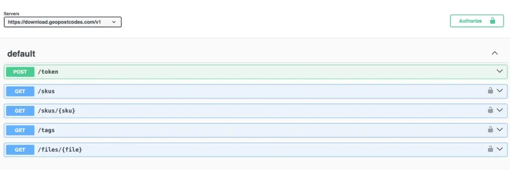
Get automatic differential updates and a list of historical ID changes by using our download API.
Flexible data formats include

Normalized
The Normalized tables provide unique and interrelated lists of the entities in the dataset: countries, administrative levels, cities, and postal codes. The tables are linked through record IDs. Constraints such as uniqueness, foreign keys, etc. ensure the integrity of the data.
Denormalized
The easiest format to integrate into your systems. All data are combined into one comprehensive table for immediate access.
Complete your geodataset

Zip code data
Global dataset containing all administrative divisions, cities and zip codes.

Boundary data
A global data set of polygons representing postal codes and administrative areas.
Population Database
Global population estimates at zip code and administrative level covering a span of 55 years: past, present, and future.
Check our related articles


Frequently Asked Questions
The address database typically refers to a comprehensive collection of physical addresses, including street names, house numbers, cities, and postal codes, used for various purposes like mail delivery, location-based services, and more.
In many countries, the local government maintains a national address database to facilitate mail delivery, federal government services, and census purposes. The USPS manages the National Address Database (NAD), a state data compilation of validated mailing addresses in the United States.
The U.S. Department of Transportation (USDOT) and its partners from all federal government levels, such as the Federal Geographic Data Committee, recognized the need for a National Address Database (NAD). An accurate and up-to-date national address database is critical to transportation safety.
The National Address Database (NAD) is a compilation of data provided by state, local, and tribal governments and is made available “as is.”. It is a work of the federal government and as such, is not subject to copyright protection. As state address programs expand and mature, USDOT expects the coverage to expand as well.
USPS does maintain a National Address Database (NAD) comprising accurate location information for mail delivery efficiency and validation purposes.
Addresses in a database are stored using a structured format, usually separating elements like street name, house number, city, state, and ZIP code into distinct fields for easy retrieval and organization. Various national address databases use different formats, but they commonly employ relational structures or key-value pairs to store address information efficiently.
Some addresses, like businesses and government offices, are publicly accessible.
Personal information linked to residential addresses (name, phone number, ID number) is classified as private.
Each country has its own set of regulations on data protection.
When handling address information, it’s recommended to use authorized databases like GeoPostcodes.
Weekly updates
Our advanced data pipelines capture, clean, format and integrate over 1500 worldwide data sources on a daily basis, allowing us to deliver the most up-to-date global picture to our customers at any time. Subscribe to our continuous updates and stay in sync with postal and administrative changes around the globe. Our long-standing partnerships with national and international postal operators guarantee the timely delivery of accurate information.