

International
ZIP Code Database

Enterprise-grade location data covering 247 countries, curated from 1,500 sources.

Explore our international ZIP code database coverage

One source of truth

A single database curated from 1,500 authoritative sources, including postal operators and official governments.

Standardized structure

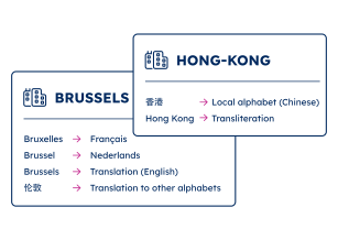
Unified global ZIP code structure with standardized fields, multi-language support, and consistent administrative levels.

Always up-to-date

Regular updates from our data specialists to reflect the world’s changing geography.

Key features of our international ZIP code database

Fully and accurately geocoded

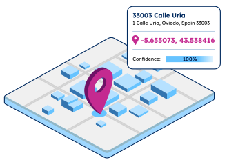
Geographic coordinates (latitude and longitude) are provided for all ZIP codes, cities, and towns in the WGS 84 coordinate system.

Achieve global geocoding accuracy

"GeoPostcodes has helped us enrich our internal data with accurate coordinates for postal code matching on a global basis. We calculate distances between the customer’s home address and different event venues to calculate event relevance and optimize marketing activities and spending."

Dr. Timo

Dr. Timo

Head of Customer Analytics & Campaign Management, Eventim
Fully and accurately geocoded

Use cases for the international ZIP code database

Powering enterprise solutions and product innovation for businesses worldwide

Address Validation

Capture accurate addresses for every country and territory in the world, in any language, and match local requirements.

Reporting and business intelligence

Ensure compliant and accurate reports across your organization. Enhance data analysis with location intelligence.

Logistics and shipping

Design and optimize your distribution network, plan your pick-up and drop-off locations, reduce costs and improve visibility over your shipping.

Map and visualization

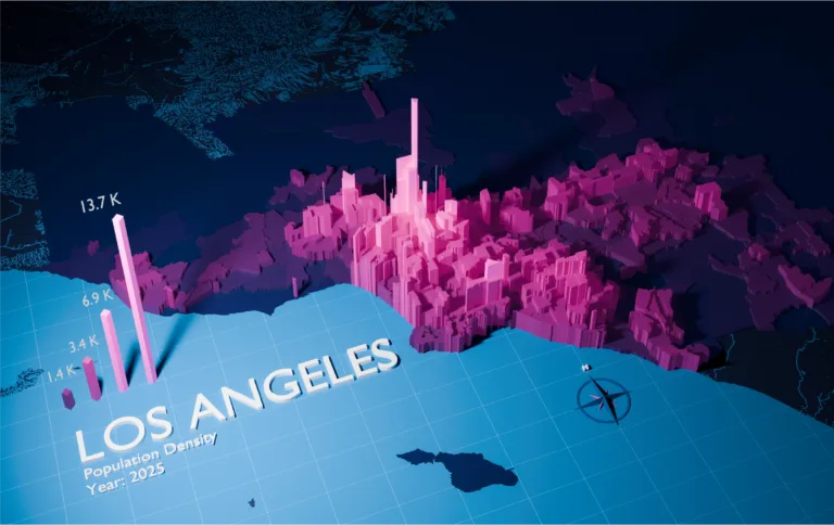
Analyze complex trends and discover actionable insights. Build engaging and intuitive map-based data visualizations.

Master data management

Rely on a single source of truth to ensure accuracy, consistency, and timeliness across your systems and organization.

Sales and marketing

Segment customers for site selection, analytics, geofencing, campaigns, mapping, and targeted ads.

Trusted by industry leaders

Join more than 100 enterprise clients who trust GeoPostcodes for their location data

GeoPostcodes - Ecotransit logo
“GeoPostcodes’ global ZIP codes allow us to determine distances accurately. Thanks to their up-to-date database, we no longer have problems with missing locations, making our system much more efficient and reliable.”

Anjo Grebe

Consultant

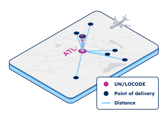
“GeoPostcodes databases provide IATA codes, enhanced UNLOCODEs with port terminal data, addresses, and more – all on a global scale! This level of accuracy is essential for our mileage and CO2 emissions calculation.”
GeoPostcodes - Peter Wild CarbonCare

Dr. Peter Wild

Managing Partner

“GeoPostcodes’ Population data shows population forecasts over the next years. We can use it as a proxy to justify longer-term changes and downgrade postal code areas in terms of economic viability.”

Kousha Mazloumi

Director of Data Science

“The concept of the city receives different names or belongs to different hierarchical levels depending on the country. Using GeoPostcodes’ data gave us access to city definitions aligned with our customers’ expectations, saving us computation time.”

Kousha Mazloumi

Director of Data Science

GeoPostcodes - Logo_DB_Schenker
“The world is constantly changing. New localities and neighborhoods open up or become dispersed. It’s good to know that GeoPostcodes is keeping on top of those changes and providing us with updated information to work with.”

GeoPostcodes-GeoPostcodes-William chao picture

William Chao

Product Owner of Geographic Information Services

GeoPostcodes - Bark Logo
“The key aspect of working with GeoPostcodes has been their ability to provide customized data solutions. Their collaborative approach has made them an excellent partner in addressing our location data challenges.”

Kate Kilby

Senior Product Manager

GeoPostcodes - Opterrix-logo
“GeoPostcodes’ multi-level boundaries were perfectly aligned, enabling seamless integration with multiple secure cloud platforms. Our software can now provide more accurate visualizations for risk analysis and natural hazard monitoring.”

Dave Hamm

Project Manager

“Countries like Brazil or China are particularly strict with their customs validation. GeoPostcodes’ ZIP codes and Enhanced UNLOCODES database are aligned with national regulations, ensuring seamless transportation and compliance.”
GeoPostcodes - Kavian Ranjbar

Kavian Ranjbar

Data Governance Specialist

“If you’ve got a business where locations are a big part of it and you’re looking to avoid the large costs that can be involved in using APIs, GeoPostcodes’ on-premise database is definitely worth considering.”
GeoPostcodes-Nick Baugie

Nick Beaugié

Senior Software Engineer

Why choose GeoPostcodes

Global coverage

Complete coverage across 247 countries, including hard-to-source geographies like China, Japan, Brazil, and Russia.

Highest quality

Built on extensive, authoritative sourcing with robust data engineering and quality control. Standardized and up-to-date.

Expert Consulting

With 15 years of experience, we guide your implementation and deliver data in the format that fits your system.

How to integrate our self-hosted database

Flexible deployment, seamless integration and structured updates, all within your own infrastructure.

1

Choose your delivery method

Select the delivery option that fits your infrastructure.

Manual download

Download the full database directly from your Customer Portal.

Download API

Retrieve the full files via API for automated ingestion into your pipeline.

Cloud-to-cloud

Access the data in your cloud environment: Snowflake, Azure Data Share or AWS.

2

Integrate into your system

Import the data easily into any software, database, ERP, CRM, MDM, GIS, BI and GIS system.

3

Stay up to date

Frequent updates will keep your data always up-to-date.

Bulk updates

Download full, updated datasets to refresh your system.

Differential updates

Retrieve only the new, updated and deleted records to ensure integrity and traceability.

Data dictionary

Comprehensive field definitions and data specifications from GeoPostcodes ZIP code database

Field nameDescriptionField type
ISOISO 3166-1 country codeChar(2)
CountryCountry nameChar(50)
LanguageLanguage codeChar(2)
IDRecord identifierInteger
Region 1Administrative division level 1Char(80)
Region 2Administrative division level 2Char(80)
Region 3Administrative division level 3Char(80)
Region 4Administrative division level 4Char(80)
LocalityLocality nameChar(80)
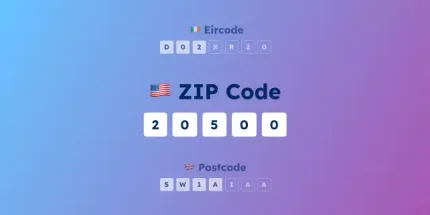
PostcodeZIP / Postal codeChar(15)
SuburbLocality subdivisionChar(80)
LatitudePlace latitude (WGS84 coordinates)Double
LongitudePlace longitude (WGS84 coordinates)Double
ElevationElevation in metersInteger
ISO2ISO 3166-2 region codeChar(10)
FIPSThe Federal Information Processing Standard, publication 10-4 (FIPS 10-4)Char(10)
NUTSEuropean statistical division codeChar(12)
HASCHierarchical administrative subdivision codeChar(12)
STATNational statistics/census codeChar(20)
TimezoneTime zone name (Olson)Char(30)
UTCStandard time expressed as an offset with respect to UTCChar(10)
DSTDaylight saving time expressed as an offset with respect to UTCChar(10)
locality_typeType of place, ‘town’ or ‘business’Char(20)
is_postalWhether the postal code is used for regular mailInteger
is_businessWhether the postal code is used for businessesInteger
is_po_boxWhether the postal code is used for PO BoxesInteger
post_townPostal Town (e.g. USPS recommended city)Char(80)
BLOG

Check our related articles

Frequently Asked Questions

The International ZIP Code Database covers 247 countries and territories, including hard-to-source geographies like China, Japan, Brazil, and Russia.

Every country is delivered within a unified global structure, so your team can easily add markets without changing how you handle the data.

View the full list in our coverage table.

The International ZIP Code Database is updated regularly to reflect the world’s postal and administrative changes. The update frequency varies by country.

You can choose when you update the data in your system:

  • Bulk updates: Download full, updated datasets to refresh your system.
  • Differential updates: Retrieve only the new, updated and deleted records to ensure integrity and traceability.

The International ZIP Code Database is curated from 1,500 authoritative sources, including national postal operators (like Swiss Post or Correos de México), official governments, statistical offices, and administrative and regulatory bodies.

All data undergoes robust data engineering and quality control processes and is standardized in a unified, global structure.

Common use cases for the International ZIP Code Database include:

  • Address validation: Verify that addresses are complete, correctly formatted, and match local postal standards, in every country and every language.
  • Distance calculation: Compute distances between ZIP codes to power radius searches, routing decisions, shipping tariffs, mileage and CO₂ reporting for ESG, job-to-candidate matching, and location-based ad targeting.
  • Logistics and shipping: Design and optimize your distribution network, enable cross-border shipping, and ensure delivery success.
  • Reporting and business intelligence: Produce compliant and accurate reports across your organization, and enhance data analysis with location intelligence.
  • Map visualization: Analyze complex trends and discover actionable insights. Build engaging map-based data visualizations.
  • Master Data Management: Rely on a single source of truth to keep location data accurate, consistent, and current across your systems and organization.
  • Sales and Marketing: Segment customers for site selection, analytics, geofencing, campaigns, territory mapping, and ad targeting.

Yes. GeoPostcodes datasets are provided in text files (the most popular format is CSV), so you can easily import the International ZIP Code Database into any software, database, ERP, CRM, MDM, GIS, or BI system.

Customers commonly integrate it with Power BI, Tableau, Carto, Microsoft Dynamics 365, Salesforce, SAP, Oracle, Sage, Esri, QGIS, and Informatica.

The International ZIP Code Database is delivered in the following formats: CSV, ASC, GeoJSON, and Shapefile. The most popular format is CSV.

GeoPostcodes delivers its data in text files (the most popular format is CSV) that you can easily integrate into your databases and processes. Hosting your own data gives you full control over security, compliance, and performance at a fixed cost, regardless of volume. Learn more about the benefits of working with self-hosted data here.

Choose the delivery method that fits your infrastructure best:

  • Manual download: Download the full database from your secure space in the GeoPostcodes Customer Portal.
  • Download API: Retrieve the files via API for automated ingestion into your pipeline.
  • Cloud-to-cloud: GeoPostcodes syncs the data directly to your cloud environment (Snowflake, Azure Data Share, or AWS).

The International ZIP Code Database is updated regularly to reflect the world’s postal and administrative changes. You can choose when you update the data in your system:

  • Bulk updates: Download full, updated datasets to refresh your system.
  • Differential updates: Retrieve only the new, updated, and deleted records to ensure integrity and traceability.

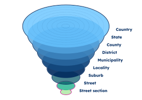
The International ZIP Code Database covers every ZIP code across 247 countries and territories, each linked to its city, town, administrative divisions up to 4 levels deep.

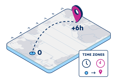
Records also carry additional attributes: latitude and longitude, statistical codes (ISO, FIPS, NUTS, HASC, and STAT), and time zone. For multilingual countries, records include official names in multiple languages, supporting accurate localization and a consistent user experience.

For the full list of fields, see the data dictionary.

Yes, the International ZIP Code Database includes latitude and longitude for each ZIP code. The coordinates correspond to the ZIP code center.

Yes. Sample datasets are available for every country in the International ZIP Code Database, so your team can check coverage, schema, and quality for your target markets before you commit.

Create a free account in our Portal to browse and download samples for the countries you’re evaluating.

Contact us to discuss your project and coverage needs. We will then schedule a call to understand your use case, answer any questions, and share sample data for evaluation. Once the agreement is signed, we will activate your dataset and introduce you to your Customer Success Manager, who will guide you through onboarding and help you integrate the data.

GeoPostcodes’ annual licenses are priced per product, based on the countries you need and your use case. Our licenses include access to your data, ongoing updates, and support from a dedicated expert who guides the integration and answers your team’s questions.

Share your needs with our team, and we will prepare a proposal tailored to your project.