

Key takeaways
- Many countries use numeric formats, while others use alphanumeric systems
- Format length ranges from 3 digits to 10 characters for the country’s postal system
- Some countries don’t use postal codes (e.g., Angola, Bahamas), while others use a single code nationwide
- Formats can change over time; some countries have both old and new systems in use
- GeoPostcodes is the most comprehensive international postal code data
Introduction
Have you ever wondered why a ZIP code in the United States looks different from a postal code in the United Kingdom? Or why some countries don’t even use postal codes at all? For companies managing international address data, these differences can create real challenges.
Postal codes-also called ZIP codes, postal codes, postcodes, or PIN codes depending on the country-are a key component of address systems worldwide. While the terms are often used interchangeably, each country defines its own format, structure, and rules. For instance, the United States uses “ZIP codes,” while the United Kingdom uses “postcodes.”
For organizations operating across multiple countries, this variation matters. Systems that manage customer addresses, shipments, or location data must handle different postal formats correctly. Incorrect or improperly formatted postal codes can lead to delivery failures, data quality issues, or validation errors in CRM, ERP, or logistics platforms.
Understanding how postal codes are structured worldwide is therefore essential for teams working with international address data. This guide explains how postal code formats differ across countries, provides examples of common systems, and outlines how developers and data teams can validate and process them correctly.
Discover the Map Explorer
Navigate, search, and explore detailed postal geographies using our US data.
| ISO | Country | Sovereign | Postal format | Postal name |
|---|---|---|---|---|
| AD | Andorra | AD999 | Postal code | |
| AE | United Arab Emirates | – | – | |
| AF | Afghanistan | 9999 | Postal code | |
| AG | Antigua and Barbuda | – | – | |
| AI | Anguilla | GB | AI-2640 | Postcode |
| AL | Albania | 9999 | Kodi Postar | |
| AM | Armenia | 9999 | Փոստային ինդեքս | |
| AO | Angola | – | – | |
| AR | Argentina | A9999 AAA | CPA | |
| AS | American Samoa | US | 96799 | ZIP code |
| AT | Austria | 9999 | PLZ | |
| AU | Australia | 9999 | Postcode | |
| AW | Aruba | NL | – | – |
| AX | Åland | FI | 99999 | Postnummer |
| AZ | Azerbaijan | AZ 9999 | Poçt indeksi | |
| BA | Bosnia and Herzegovina | 99999 | Poštanski broj | |
| BB | Barbados | 99999 | Postal code | |
| BD | Bangladesh | 9999 | Postal code | |
| BE | Belgium | 9999 | Code postal | |
| BF | Burkina Faso | 99999 | – | |
| BG | Bulgaria | 9999 | Пощенски код | |
| BH | Bahrain | [9]999 | Block | |
| BI | Burundi | – | – | |
| BJ | Benin | – | – | |
| BL | Saint Barthélemy | FR | 99999 | Code postal |
| BM | Bermuda | GB | AA 99 | Postcode |
| BN | Brunei Darussalam | AA9999 | Postal code | |
| BO | Bolivia | – | – | |
| BR | Brazil | 99999-999 | CEP | |
| BS | Bahamas | – | – | |
| BT | Bhutan | 99999 | Postcode | |
| BV | Bouvet Island | NO | – | Postnummer |
| BW | Botswana | – | – | |
| BY | Belarus | 299999 | Паштовы індэкс | |
| BZ | Belize | – | – | |
| CA | Canada | A9A 9A9 | Postal code | |
| CC | Cocos (Keeling) Islands | AU | 6799 | Postcode |
| CD | Congo, Democratic Republic | 9999999 | Code postal | |
| CF | Central African Republic | – | – | |
| CG | Congo-Brazzaville | – | – | |
| CH | Switzerland | 9999 | NPA | |
| CI | Côte d’Ivoire | – | – | |
| CK | Cook Islands | NZ | – | – |
| CL | Chile | 9999999 | Código postal | |
| … | … | … | … | … |
💡 You can download the table above for free for practical application. It provides a first-level validation of the postal code system, which can be helpful when designing address forms or data standards for your business.
Understanding ZIP code formats worldwide
Different countries use different systems for their postal codes, also known as ZIP codes, postal codes, postcodes, PIN codes, CAP codes, or Eircodes. These codes are essential for sorting mail, but they are also widely used in digital systems that manage addresses, shipments, or customer data.
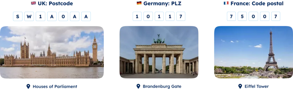
For example, sending a shipment to Germany requires the correct PLZ (Postleitzahl), while mapping customer addresses in Brazil requires understanding the CEP (Código de Endereçamento Postal) format. Each country defines its own structure and naming conventions, which can create challenges for organizations working with international address data.
💡 For over 15 years, we have curated the most comprehensive worldwide postal code database. Our location data is kept up to date and compiled from more than 1,500 sources. Browse GeoPostcodes datasets and download a free sample here.
Postal code structures vary widely. Some countries use purely numeric systems, while others combine letters and numbers. Formats can also differ in length and internal structure depending on how each country organizes its postal network.
For example:
- Canada uses an alphanumeric format such as A9A 9A9, identifying areas down to a neighborhood level.
- Saudi Arabia uses a five-digit numeric system.
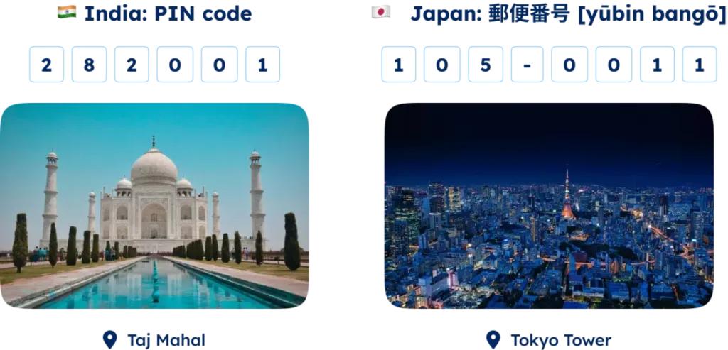
- Japan uses a seven-digit format like 999-9999, designed to support efficient mail distribution in dense urban areas.
Terminology also varies across countries. In Australia, they are called postcodes, in Italy CAP codes, and in France code postaux. While the naming differs, the purpose remains the same: identifying geographic areas to support mail delivery and address management.
Postal code format variations across continents
Postal code formats and usage vary worldwide, reflecting geographical, administrative, and cultural differences.
Europe
In Europe, most countries opt for a four or five-digit numeric code. Notable exceptions include the UK and the Netherlands, which use alphanumeric postcodes of six to eight characters. Germany and France employ five-digit codes that start with a regional digit, similar to Spain and Portugal’s system, which uses the first two digits to represent the province.
North America
In North America, a five-digit numeric code prevails, with the US incorporating an optional four-digit extension for precision. Canada refers to them as postal codes, while Mexico‘s system includes a five-digit code, indicating the state with the first two digits.
South America
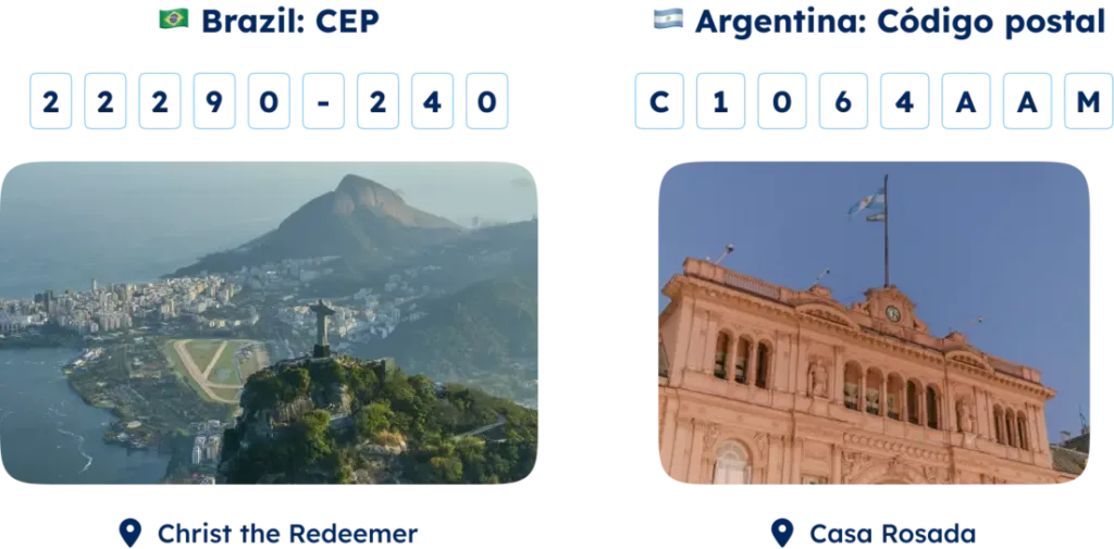
South America generally uses four or five-digit numeric codes. Still, Argentina and Brazil stand out with eight-digit alphanumeric codes, which designate state or region in the first part and city or district in the second. Colombia and Ecuador use a six-digit numeric system, dividing the code between department or province and municipality or parish.
Asia
Asian countries broadly use five or six-digit numeric codes. China and Japan’s systems specify the province or prefecture with the first digits and the city or district with the remaining ones. India and Cambodia start their six-digit codes with a zone indicator, while Singapore and Taiwan’s six-digit codes uniquely identify sectors or buildings.
South Korea and Vietnam use a five-digit postal code system.
Africa
In Africa, postal code adoption varies across countries.
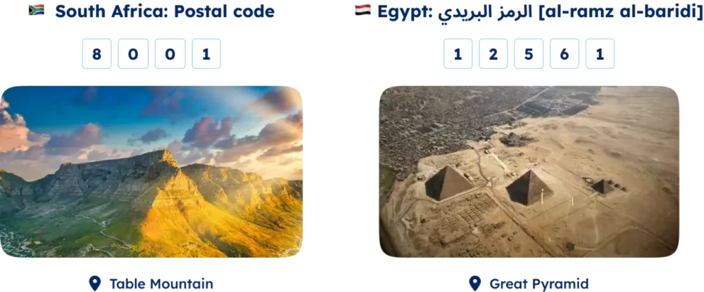
Countries like Nigeria and Malawi employ a six-digit code to signify regions and delivery areas. South Africa and Tunisia use a four-digit system, indicating the province or county, whereas Egypt and Algeria’s five-digit code denote the city or zone.
Oceania
Oceania’s approach typically involves a four-digit numeric code, with Australia and New Zealand indicating state or island with the first digit. Papua New Guinea uses a three-digit code representing the province or division.

Understanding these diverse formats is crucial for businesses engaged in international logistics, ensuring accurate address data and efficient delivery. GeoPostcodes offers comprehensive data solutions to help navigate these complexities, enabling smoother global operations.
Decoding ZIP code structures in some countries
United States ZIP codes
The United States uses a five-digit numeric ZIP code system established in 1963 by the USPS. It splits into two segments: the first three digits represent the sectional center facility (SCF), a key mail sorting and distribution hub, while the last two digits pinpoint the exact delivery area, such as a city or rural zone.
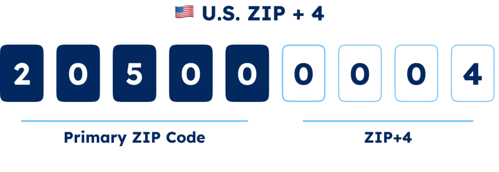
In 1983, USPS introduced a ZIP+4 code system, adding a four-digit extension for a more precise location and enhancing delivery speed and accuracy.
The White House ZIP+4 code is 20500-0004, where “205” is the SCF for Washington, DC, “00” specifies the delivery area, and “0004” pinpoints the exact location within the White House.
Canada’s postal codes
Canada’s system, launched in 1971 by Canada Post, features six-character alphanumeric postal codes. It has two halves: the Forward Sortation Area (FSA) and the Local Delivery Unit (LDU), which pinpoint geographic and specific locations, respectively, such as K1A 0A9 for Parliament Hill.
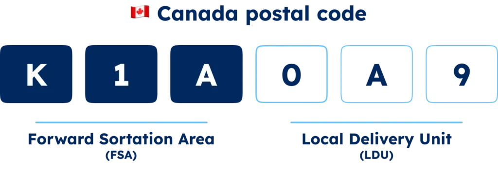
The first character notes the province or territory, with subsequent characters detailing whether the area is urban or rural, the specific area, and the particulars of the LDU, down to the delivery mode.
The UK’s alphanumeric postcodes
The UK’s postcode model, started in 1959 by the Royal Mail, is divided into two parts: the outward code for geographic sorting areas and the inward code for specific locales within, for example, SW1A 1AA at Buckingham Palace.

Other formats
Diverse formats exist globally, such as:
- Japan’s seven-digit code separates prefecture and town/city ward with a hyphen, like 100-0000 for Chiyoda City, Tokyo
- Brazil’s eight-digit postal code, divided by a hyphen to differentiate the postal district from the postal suffix, indicating specific internal locations, 01000-000, references São Paulo’s central zone
- Argentina adopts an eight-character system, mixing alphanumeric symbols for street segments or delivery points and an older, locality-indicating four-digit code, exemplified by C1406 AAA for a Buenos Aires segment
How can systems parse and validate ZIP codes?
Organizations managing international address data must ensure that postal codes entered into their systems follow the correct format for each country. This process typically involves parsing postal codes to extract geographic information and validating them against country-specific rules.
One common approach is to use regular expressions (regex) to define patterns that match valid postal codes. For example, a regex pattern for UK postcodes might look like:
^[A-Z]{1,2}[0-9][A-Z0-9]? ?[0-9][A-Z]{2}$
This pattern matches postcodes such as SW1A 2AA. Regex is compatible with many languages, including Python, JavaScript, and Ruby.
However, maintaining regex rules for multiple countries quickly becomes complex. Each postal system follows its own structure, length, and formatting rules. As organizations expand internationally, validation logic must be updated to support additional formats and exceptions.
For this reason, many address validation systems rely on reference datasets containing country-specific postal code formats and geographic mappings. These datasets allow systems to validate and standardize postal codes automatically across countries, reducing errors in address databases and operational systems.
Deploy standardized ZIP code data in global address systems
Supporting global postal code formats requires more than simple format validation. Organizations managing international address data must handle country-specific rules, changing postal systems, and geographic mappings across hundreds of jurisdictions.
GeoPostcodes provides standardized postal code datasets covering 247 countries, compiled from more than 1,500 authoritative sources and regularly updated to reflect changes in national postal systems.
These datasets are commonly used to support:
Address validation: Verify postal codes and address components against reliable reference data to reduce errors in shipping, billing, and customer records.
Master Data Management (MDM): Standardize and maintain consistent address data across CRM, ERP, and operational systems.
Address autocomplete: Improve address entry accuracy by suggesting valid locations and postal codes as users type.
Mapping and analytics: Link postal codes to geographic coordinates or boundaries and create detailed maps to support location analysis, market segmentation, and operational planning.
GeoPostcodes datasets can also be integrated with common platforms such as Salesforce, Microsoft Dynamics 365, Tableau, andPython-based data pipelines, enabling teams to incorporate reliable location data directly into their systems.
Conclusion
Postal code formats vary widely across countries, with different structures, naming conventions, and validation rules. For teams managing international address data, these differences can introduce complexity when validating addresses, maintaining master data, or integrating location data across systems.
Reliable reference data is essential to handle these variations consistently.
GeoPostcodes provides standardized global postal code and address datasets covering 247 countries, designed to support address validation, data standardization, and location-based analysis across international systems.
Browse GeoPostcodes datasets and download a free sample to explore how standardized postal code data can support your address infrastructure.
FAQ
What is the best source of international ZIP codes?
GeoPostcodes provides the most accurate postal code data in global location database.
It contains ZIP codes, cities, addresses, boundaries, and population data covering 247 countries, including hard-to-source countries like China, Japan, and Brazil.
We deliver high-quality data through standardized, up-to-date datasets curated from over 1,500 authoritative sources.
With 15 years of experience, GeoPostcodes provides expert consulting to ensure seamless implementation in your systems.
Our self-hosted solution offers complete control over the data, ensuring security, compliance, and performance at a fixed cost.
Fortune 500 companies such as Amazon, EY, IBM, and DB Schenker use GeoPostcodes data for address validation, distance calculation, and map visualization.
We power critical operations across logistics, e-commerce, advertising, market research, and marketplaces worldwide.
What is an international ZIP code format?
An international postal code format refers to the structure used by each country to represent postal codes.
Formats vary widely and may include numeric codes (such as five digits in the United States) or alphanumeric combinations (such as UK postcodes).
In other words, every national postal system defines its own rules for how postal codes are written.
Why do ZIP code formats differ between countries?
ZIP code formats differ because each country designs its postal system based on its geography, administrative structure, and mail distribution network.
Some systems prioritize regional sorting, while others identify smaller delivery zones.
This means the structure, length, and characters used in postal codes vary worldwide.
How many digits can an international ZIP code contain?
International postal codes typically range from three digits to ten characters depending on the country.
Some countries use short numeric formats, while others use longer alphanumeric codes with spaces or hyphens.
For example, Japan uses a seven-digit code, while Canada uses a six-character alphanumeric format.
Do all countries use postal codes or ZIP codes?
No, not all countries use postal codes.
Some countries operate without a national postal code system, while others use a single code for the entire country.
For example, Angola and the Bahamas do not use postal codes for standard addressing.
What is the difference between a ZIP code, postal code, and postcode?
The terms ZIP code, postal code, and postcode refer to the same concept: a code that identifies a geographic delivery area.
The difference lies in regional terminology.
For example, the United States uses ZIP code, while many other countries use postal code or postcode.
How do developers validate international ZIP code formats?
Developers often validate international postal code formats using regular expressions (regex) that match country-specific patterns.
However, managing hundreds of postal systems with regex alone can become complex.
Many organizations therefore rely on reference datasets containing verified postal code formats and geographic mappings.
What are the four types of ZIP Codes?
ZIP Codes come in four main varieties:
Standard: Covers broader geographic areas and represents the majority of postal codes.
Unique: Assigned to singular high-volume locations, like government offices or universities.
PO box-only: Exclusively for PO boxes at a specific facility, not for street deliveries.
Military: Allocated for mailing to US military entities, particularly those stationed abroad.
What are the extra four digits after a ZIP code?
These extra four numbers, known as the ZIP+4 code, intensify the specificity of a postal code’s five-digit delivery area.
They can designate smaller segments, such as specific apartment buildings, office spaces, or even individual local post office boxes, streamlining mail sorting and delivery processes.
How do postal zones work?
Postal zones are designated areas within a country used by postal services to facilitate the sorting and delivery of mail.
These zones help streamline the postal process, ensuring that mail is delivered efficiently and accurately.
Each zone typically corresponds to a specific region or district, which helps organize the delivery routes.
What is a postal expedition code?
A postal expedition code is a unique identifier postal services use to expedite mail sorting and delivery.
This code is often included on packages and letters to ensure they are routed correctly and reach their destination quickly.