Worldwide Address Database
A standardized global dataset of streets, coordinates, and address ranges for enterprise and product integration.

Standardized across countries
233 address formats mapped in a unified structure with consistent administrative levels.

Multi-language support
299 languages, including local languages, foreign names, English, and transliterations.

Global city definitions
Standardized city definitions and classifications for reliable address validation.
Comprehensive address data for 247 countries
| iso | country | postal codes | coordinates | streets | languages | admin levels | time zones |
|---|---|---|---|---|---|---|---|
| North America | |||||||
| AS | American Samoa | ✔ | ✔ | 1 | 3 | 1 | |
| CA | Canada | ✔ | ✔ | ✔ | 2 | 3 | 10 |
| GU | Guam | ✔ | ✔ | ✔ | 1 | 1 | 1 |
| MH | Marshall Islands | ✔ | ✔ | 1 | 2 | 1 | |
| MX | Mexico | ✔ | ✔ | ✔ | 1 | 3 | 6 |
| UM | Minor Outlying Islands | ✔ | ✔ | 1 | 1 | 4 | |
| PR | Puerto Rico | ✔ | ✔ | ✔ | 1 | 1 | 1 |
| VI | U.S. Virgin Islands | ✔ | ✔ | ✔ | 1 | 2 | 1 |
| US | United States | ✔ | ✔ | ✔ | 1 | 2 | 8 |
| Western Europe | |||||||
| AX | Åland | ✔ | ✔ | ✔ | 2 | 3 | 1 |
| AD | Andorra | ✔ | ✔ | ✔ | 1 | 1 | 1 |
| AI | Anguilla | ✔ | ✔ | 1 | 1 | 1 | |
| AT | Austria | ✔ | ✔ | ✔ | 1 | 3 | 1 |
| BE | Belgium | ✔ | ✔ | ✔ | 2 | 4 | 1 |
| BM | Bermuda | ✔ | ✔ | ✔ | 1 | 1 | 1 |
| BV | Bouvet Island | No Valid Postal Code System | ✔ | 1 | 0 | 1 | |
| IO | British Indian Ocean Territory | ✔ | ✔ | 1 | 0 | 1 | |
| VG | British Virgin Islands | ✔ | ✔ | 1 | 1 | 1 | |
| KY | Cayman Islands | ✔ | ✔ | 1 | 1 | 1 | |
| CW | Curaçao | No Valid Postal Code System | ✔ | 1 | 0 | 1 | |
| DK | Denmark | ✔ | ✔ | ✔ | 1 | 3 | 1 |
| FK | Falkland Islands | ✔ | ✔ | 1 | 0 | 1 | |
| FO | Faroe Islands | ✔ | ✔ | ✔ | 1 | 2 | 1 |
| FI | Finland | ✔ | ✔ | ✔ | 2 | 4 | 1 |
| FR | France | ✔ | ✔ | ✔ | 1 | 4 | 1 |
| GF | French Guiana | ✔ | ✔ | ✔ | 1 | 4 | 1 |
| PF | French Polynesia | ✔ | ✔ | 1 | 2 | 3 | |
| TF | French Southern Territories | No Valid Postal Code System | ✔ | 1 | 1 | 1 | |
| DE | Germany | ✔ | ✔ | ✔ | 1 | 4 | 1 |
| GI | Gibraltar | ✔ | ✔ | ✔ | 1 | 0 | 1 |
| GR | Greece | ✔ | ✔ | 2 | 3 | 1 | |
| GL | Greenland | ✔ | ✔ | ✔ | 1 | 1 | 3 |
| GP | Guadeloupe | ✔ | ✔ | ✔ | 1 | 4 | 1 |
| GG | Guernsey | ✔ | ✔ | ✔ | 1 | 1 | 1 |
| IS | Iceland | ✔ | ✔ | ✔ | 1 | 2 | 1 |
| IE | Ireland | ✔ | ✔ | ✔ | 2 | 3 | 1 |
| IM | Isle of Man | ✔ | ✔ | ✔ | 1 | 2 | 1 |
| IT | Italy | ✔ | ✔ | ✔ | 1 | 3 | 1 |
| JE | Jersey | ✔ | ✔ | ✔ | 1 | 1 | 1 |
| LI | Liechtenstein | ✔ | ✔ | ✔ | 1 | 1 | 1 |
| LU | Luxembourg | ✔ | ✔ | ✔ | 1 | 2 | 1 |
| MT | Malta | ✔ | ✔ | ✔ | 1 | 2 | 1 |
| MQ | Martinique | ✔ | ✔ | ✔ | 1 | 4 | 1 |
| YT | Mayotte | ✔ | ✔ | ✔ | 1 | 3 | 1 |
| MC | Monaco | ✔ | ✔ | ✔ | 1 | 1 | 1 |
| MS | Montserrat | ✔ | ✔ | 1 | 1 | 1 | |
| NL | Netherlands | ✔ | ✔ | ✔ | 1 | 2 | 2 |
| NC | New Caledonia | ✔ | ✔ | 1 | 2 | 1 | |
| NO | Norway | ✔ | ✔ | ✔ | 1 | 2 | 1 |
| PW | Palau | ✔ | ✔ | 1 | 1 | 1 | |
| PN | Pitcairn Islands | ✔ | ✔ | 1 | 0 | 1 | |
| PT | Portugal | ✔ | ✔ | ✔ | 1 | 3 | 2 |
| RE | Réunion | ✔ | ✔ | ✔ | 1 | 4 | 1 |
| BL | Saint Barthélemy | ✔ | ✔ | ✔ | 1 | 0 | 1 |
| SH | Saint Helena | ✔ | ✔ | 1 | 2 | 1 | |
| MF | Saint Martin | ✔ | ✔ | ✔ | 1 | 0 | 1 |
| PM | Saint Pierre and Miquelon | ✔ | ✔ | ✔ | 1 | 1 | 1 |
| SM | San Marino | ✔ | ✔ | ✔ | 1 | 1 | 1 |
| SX | Sint Maarten | No Valid Postal Code System | ✔ | ✔ | 1 | 0 | 1 |
| GS | South Georgia and Sandwich | ✔ | ✔ | 1 | 0 | 1 | |
| ES | Spain | ✔ | ✔ | ✔ | 1 | 4 | 2 |
| SJ | Svalbard and Jan Mayen | ✔ | ✔ | ✔ | 1 | 1 | 1 |
| SE | Sweden | ✔ | ✔ | ✔ | 1 | 2 | 1 |
| CH | Switzerland | ✔ | ✔ | ✔ | 3 | 3 | 1 |
| TK | Tokelau | No Valid Postal Code System | ✔ | 1 | 0 | 1 | |
| TC | Turks and Caicos Islands | ✔ | ✔ | 1 | 2 | 1 | |
| GB | United Kingdom | ✔ | ✔ | ✔ | 1 | 4 | 1 |
| VA | Vatican | ✔ | ✔ | ✔ | 1 | 0 | 1 |
| WF | Wallis and Futuna | ✔ | ✔ | 1 | 2 | 1 | |
| Eastern Europe | |||||||
| AL | Albania | ✔ | ✔ | 1 | 3 | 1 | |
| AM | Armenia | ✔ | ✔ | 2 | 3 | 1 | |
| AZ | Azerbaijan | ✔ | ✔ | 2 | 2 | 1 | |
| BY | Belarus | ✔ | ✔ | 2 | 3 | 1 | |
| BA | Bosnia and Herzegovina | ✔ | ✔ | 1 | 3 | 1 | |
| BG | Bulgaria | ✔ | ✔ | 2 | 3 | 1 | |
| HR | Croatia | ✔ | ✔ | ✔ | 1 | 2 | 1 |
| CY | Cyprus | ✔ | ✔ | ✔ | 2 | 2 | 1 |
| CZ | Czechia | ✔ | ✔ | ✔ | 1 | 4 | 1 |
| EE | Estonia | ✔ | ✔ | ✔ | 1 | 2 | 1 |
| GE | Georgia | ✔ | ✔ | 2 | 2 | 1 | |
| HU | Hungary | ✔ | ✔ | ✔ | 1 | 3 | 1 |
| XK | Kosovo | ✔ | ✔ | ✔ | 2 | 2 | 1 |
| LV | Latvia | ✔ | ✔ | ✔ | 1 | 2 | 1 |
| LT | Lithuania | ✔ | ✔ | ✔ | 1 | 3 | 1 |
| MD | Moldova | ✔ | ✔ | 1 | 3 | 1 | |
| ME | Montenegro | ✔ | ✔ | 1 | 1 | 1 | |
| PL | Poland | ✔ | ✔ | ✔ | 1 | 3 | 1 |
| MK | Republic of North Macedonia | ✔ | ✔ | 2 | 2 | 1 | |
| RO | Romania | ✔ | ✔ | ✔ | 1 | 3 | 1 |
| RU | Russia | ✔ | ✔ | ✔ | 2 | 3 | 11 |
| RS | Serbia | ✔ | ✔ | 1 | 3 | 1 | |
| SK | Slovakia | ✔ | ✔ | 1 | 3 | 1 | |
| SI | Slovenia | ✔ | ✔ | ✔ | 1 | 2 | 1 |
| UA | Ukraine | ✔ | ✔ | ✔ | 2 | 3 | 2 |
| Asia | |||||||
| AF | Afghanistan | ✔ | ✔ | 1 | 2 | 1 | |
| BD | Bangladesh | ✔ | ✔ | 1 | 3 | 1 | |
| BT | Bhutan | ✔ | ✔ | 1 | 2 | 1 | |
| BN | Brunei Darussalam | ✔ | ✔ | 1 | 2 | 1 | |
| KH | Cambodia | ✔ | ✔ | 2 | 3 | 1 | |
| CN | China | ✔ | ✔ | 2 | 4 | 1 | |
| HK | Hong Kong | No Valid Postal Code System | ✔ | ✔ | 2 | 2 | 1 |
| IN | India | ✔ | ✔ | 1 | 4 | 1 | |
| ID | Indonesia | ✔ | ✔ | 1 | 3 | 3 | |
| JP | Japan | ✔ | ✔ | 3 | 4 | 1 | |
| KZ | Kazakhstan | ✔ | ✔ | ✔ | 3 | 2 | 1 |
| KG | Kyrgyzstan | ✔ | ✔ | 2 | 2 | 1 | |
| LA | Laos | ✔ | ✔ | 1 | 3 | 1 | |
| MO | Macau | No Valid Postal Code System | ✔ | 2 | 1 | 1 | |
| MY | Malaysia | ✔ | ✔ | ✔ | 1 | 3 | 1 |
| MV | Maldives | ✔ | ✔ | ✔ | 1 | 2 | 1 |
| MN | Mongolia | ✔ | ✔ | 2 | 2 | 2 | |
| MM | Myanmar | ✔ | ✔ | 2 | 4 | 1 | |
| NP | Nepal | ✔ | ✔ | 1 | 3 | 1 | |
| KP | North Korea | No Valid Postal Code System | ✔ | 1 | 2 | 1 | |
| PK | Pakistan | ✔ | ✔ | 1 | 3 | 1 | |
| PH | Philippines | ✔ | ✔ | 1 | 3 | 1 | |
| SG | Singapore | ✔ | ✔ | ✔ | 1 | 2 | 1 |
| KR | South Korea | ✔ | ✔ | ✔ | 2 | 3 | 1 |
| LK | Sri Lanka | ✔ | ✔ | 2 | 3 | 1 | |
| TW | Taiwan | ✔ | ✔ | ✔ | 2 | 2 | 1 |
| TJ | Tajikistan | ✔ | ✔ | 3 | 2 | 1 | |
| TH | Thailand | ✔ | ✔ | 2 | 3 | 1 | |
| TL | Timor-Leste | No Valid Postal Code System | ✔ | 1 | 3 | 1 | |
| TM | Turkmenistan | ✔ | ✔ | 1 | 2 | 1 | |
| UZ | Uzbekistan | ✔ | ✔ | 2 | 2 | 1 | |
| VN | Vietnam | ✔ | ✔ | 1 | 4 | 1 | |
| South & Central America | |||||||
| AG | Antigua and Barbuda | No Valid Postal Code System | ✔ | 1 | 1 | 1 | |
| AR | Argentina | ✔ | ✔ | ✔ | 1 | 3 | 1 |
| AW | Aruba | No Valid Postal Code System | ✔ | 1 | 1 | 1 | |
| BS | Bahamas | No Valid Postal Code System | ✔ | 1 | 1 | 1 | |
| BB | Barbados | ✔ | ✔ | 1 | 1 | 1 | |
| BZ | Belize | No Valid Postal Code System | ✔ | 1 | 1 | 1 | |
| BO | Bolivia | No Valid Postal Code System | ✔ | 1 | 3 | 1 | |
| BR | Brazil | ✔ | ✔ | ✔ | 1 | 4 | 3 |
| CL | Chile | ✔ | ✔ | ✔ | 1 | 3 | 3 |
| CO | Colombia | ✔ | ✔ | ✔ | 1 | 4 | 1 |
| CR | Costa Rica | ✔ | ✔ | 1 | 3 | 1 | |
| CU | Cuba | ✔ | ✔ | 1 | 2 | 1 | |
| DM | Dominica | No Valid Postal Code System | ✔ | 1 | 1 | 1 | |
| DO | Dominican Republic | ✔ | ✔ | 1 | 4 | 1 | |
| EC | Ecuador | ✔ | ✔ | ✔ | 1 | 3 | 2 |
| SV | El Salvador | ✔ | ✔ | 1 | 2 | 1 | |
| GD | Grenada | No Valid Postal Code System | ✔ | 1 | 1 | 1 | |
| GT | Guatemala | ✔ | ✔ | 1 | 2 | 1 | |
| GY | Guyana | No Valid Postal Code System | ✔ | 1 | 2 | 1 | |
| HT | Haiti | ✔ | ✔ | 1 | 4 | 1 | |
| HN | Honduras | ✔ | ✔ | 1 | 2 | 1 | |
| JM | Jamaica | No Valid Postal Code System | ✔ | 1 | 1 | 1 | |
| NI | Nicaragua | ✔ | ✔ | 1 | 2 | 1 | |
| PA | Panama | ✔ | ✔ | 1 | 3 | 1 | |
| PY | Paraguay | ✔ | ✔ | 1 | 3 | 1 | |
| PE | Peru | ✔ | ✔ | 1 | 3 | 1 | |
| KN | Saint Kitts and Nevis | ✔ | ✔ | 1 | 1 | 1 | |
| LC | Saint Lucia | ✔ | ✔ | 1 | 1 | 1 | |
| VC | St. Vincent and the Grenadines | ✔ | ✔ | 1 | 1 | 1 | |
| SR | Suriname | No Valid Postal Code System | ✔ | 1 | 2 | 1 | |
| TT | Trinidad and Tobago | ✔ | 1 | 2 | 1 | ||
| UY | Uruguay | ✔ | ✔ | ✔ | 1 | 2 | 1 |
| VE | Venezuela | ✔ | ✔ | 1 | 3 | 1 | |
| Middle East | |||||||
| BH | Bahrain | ✔ | ✔ | 1 | 1 | 1 | |
| IR | Iran | ✔ | ✔ | 2 | 1 | 1 | |
| IQ | Iraq | ✔ | ✔ | 2 | 2 | 1 | |
| IL | Israel | ✔ | ✔ | ✔ | 2 | 3 | 1 |
| JO | Jordan | ✔ | ✔ | 2 | 3 | 1 | |
| KW | Kuwait | ✔ | ✔ | 2 | 1 | 1 | |
| LB | Lebanon | ✔ | 2 | 3 | 1 | ||
| OM | Oman | ✔ | ✔ | 2 | 2 | 1 | |
| PS | Palestine | ✔ | ✔ | 2 | 2 | 1 | |
| QA | Qatar | No Valid Postal Code System | ✔ | ✔ | 2 | 2 | 1 |
| SA | Saudi Arabia | ✔ | ✔ | 2 | 2 | 1 | |
| SY | Syria | No Valid Postal Code System | ✔ | 2 | 3 | 1 | |
| TR | Türkiye | ✔ | ✔ | 1 | 4 | 1 | |
| AE | United Arab Emirates | No Valid Postal Code System | ✔ | 1 | 2 | 1 | |
| YE | Yemen | No Valid Postal Code System | ✔ | 2 | 2 | 1 | |
| Africa | |||||||
| DZ | Algeria | ✔ | ✔ | 1 | 3 | 1 | |
| AO | Angola | No Valid Postal Code System | ✔ | 1 | 3 | 1 | |
| BJ | Benin | No Valid Postal Code System | ✔ | 1 | 2 | 1 | |
| BW | Botswana | No Valid Postal Code System | ✔ | 1 | 2 | 1 | |
| BF | Burkina Faso | ✔ | ✔ | 1 | 3 | 1 | |
| BI | Burundi | No Valid Postal Code System | ✔ | 1 | 3 | 1 | |
| CM | Cameroon | No Valid Postal Code System | ✔ | 1 | 3 | 1 | |
| CV | Cape Verde | ✔ | ✔ | 1 | 2 | 1 | |
| CF | Central African Republic | No Valid Postal Code System | ✔ | 1 | 3 | 1 | |
| TD | Chad | No Valid Postal Code System | ✔ | 1 | 3 | 1 | |
| KM | Comoros | No Valid Postal Code System | ✔ | 1 | 2 | 1 | |
| CG | Congo-Brazzaville | No Valid Postal Code System | ✔ | 1 | 2 | 1 | |
| CD | Congo, Democratic Republic | ✔ | ✔ | 1 | 3 | 2 | |
| DJ | Djibouti | No Valid Postal Code System | ✔ | 1 | 2 | 1 | |
| EG | Egypt | ✔ | ✔ | 2 | 2 | 1 | |
| GQ | Equatorial Guinea | No Valid Postal Code System | ✔ | 1 | 3 | 1 | |
| ER | Eritrea | No Valid Postal Code System | ✔ | 1 | 2 | 1 | |
| SZ | Eswatini | ✔ | ✔ | 1 | 2 | 1 | |
| ET | Ethiopia | No Valid Postal Code System | ✔ | 1 | 3 | 1 | |
| GA | Gabon | No Valid Postal Code System | ✔ | 1 | 2 | 1 | |
| GM | Gambia | No Valid Postal Code System | ✔ | 1 | 2 | 1 | |
| GH | Ghana | ✔ | ✔ | 1 | 2 | 1 | |
| GN | Guinea | No Valid Postal Code System | ✔ | 1 | 4 | 1 | |
| GW | Guinea-Bissau | No Valid Postal Code System | ✔ | 1 | 3 | 1 | |
| CI | Ivory Coast | No Valid Postal Code System | ✔ | 1 | 4 | 1 | |
| KE | Kenya | ✔ | ✔ | 1 | 3 | 1 | |
| LS | Lesotho | ✔ | ✔ | 1 | 2 | 1 | |
| LR | Liberia | ✔ | 1 | 3 | 1 | ||
| LY | Libya | No Valid Postal Code System | ✔ | 1 | 1 | 1 | |
| MG | Madagascar | ✔ | ✔ | 1 | 4 | 1 | |
| MW | Malawi | ✔ | ✔ | 1 | 2 | 1 | |
| ML | Mali | ✔ | ✔ | 1 | 3 | 1 | |
| MR | Mauritania | No Valid Postal Code System | ✔ | 1 | 3 | 1 | |
| MU | Mauritius | ✔ | ✔ | 1 | 1 | 1 | |
| MA | Morocco | ✔ | ✔ | 2 | 4 | 1 | |
| MZ | Mozambique | ✔ | ✔ | 1 | 3 | 1 | |
| NA | Namibia | ✔ | ✔ | 1 | 2 | 1 | |
| NE | Niger | ✔ | ✔ | 1 | 3 | 1 | |
| NG | Nigeria | ✔ | ✔ | 1 | 3 | 1 | |
| RW | Rwanda | No Valid Postal Code System | ✔ | 1 | 3 | 1 | |
| ST | São Tomé and Príncipe | No Valid Postal Code System | ✔ | 1 | 2 | 1 | |
| SN | Senegal | ✔ | ✔ | 1 | 4 | 1 | |
| SC | Seychelles | No Valid Postal Code System | ✔ | 1 | 1 | 1 | |
| SL | Sierra Leone | No Valid Postal Code System | ✔ | 1 | 3 | 1 | |
| SO | Somalia | No Valid Postal Code System | ✔ | 1 | 2 | 1 | |
| ZA | South Africa | ✔ | ✔ | 2 | 3 | 1 | |
| SS | South Sudan | No Valid Postal Code System | ✔ | 1 | 2 | 1 | |
| SD | Sudan | No Valid Postal Code System | ✔ | 1 | 2 | 1 | |
| TZ | Tanzania | ✔ | ✔ | ✔ | 1 | 3 | 1 |
| TG | Togo | No Valid Postal Code System | ✔ | 1 | 2 | 1 | |
| TN | Tunisia | ✔ | ✔ | 1 | 2 | 1 | |
| UG | Uganda | ✔ | ✔ | 1 | 4 | 1 | |
| ZM | Zambia | No Valid Postal Code System | ✔ | 1 | 2 | 1 | |
| ZW | Zimbabwe | No Valid Postal Code System | ✔ | 1 | 3 | 1 | |
| Oceania-Pacific | |||||||
| AU | Australia | ✔ | ✔ | ✔ | 1 | 2 | 6 |
| CX | Christmas Island | ✔ | ✔ | ✔ | 1 | 0 | 1 |
| CC | Cocos (Keeling) Islands | ✔ | ✔ | ✔ | 1 | 0 | 1 |
| CK | Cook Islands | No Valid Postal Code System | ✔ | 1 | 4 | 1 | |
| FJ | Fiji | No Valid Postal Code System | ✔ | 1 | 3 | 1 | |
| HM | Heard and McDonald Islands | ✔ | ✔ | 1 | 0 | 1 | |
| KI | Kiribati | ✔ | ✔ | 1 | 2 | 3 | |
| FM | Micronesia | ✔ | ✔ | 1 | 2 | 2 | |
| NR | Nauru | ✔ | ✔ | 1 | 1 | 1 | |
| NZ | New Zealand | ✔ | ✔ | ✔ | 1 | 2 | 2 |
| NU | Niue | ✔ | ✔ | 1 | 1 | 1 | |
| NF | Norfolk Island | ✔ | ✔ | ✔ | 1 | 0 | 1 |
| MP | Northern Mariana Islands | ✔ | ✔ | 1 | 2 | 1 | |
| PG | Papua New Guinea | ✔ | ✔ | 1 | 3 | 2 | |
| WS | Samoa | ✔ | ✔ | 1 | 2 | 1 | |
| SB | Solomon Islands | No Valid Postal Code System | ✔ | 1 | 1 | 1 | |
| TO | Tonga | No Valid Postal Code System | ✔ | 1 | 2 | 1 | |
| TV | Tuvalu | No Valid Postal Code System | ✔ | 1 | 1 | 1 | |
| VU | Vanuatu | No Valid Postal Code System | ✔ | 1 | 1 | 1 |
The sample includes data for 247 countries
Our data in numbers
Our Address database gives you the accurate, standardized reference data you need, including:
Fully and accurately geocoded
Fully and accurately geocoded
Multi-language support
Multi-language support
International Address Formats
International Address Formats
Comprehensive city definitions
Comprehensive city definitions
Administrative divisions
Administrative divisions
Address ranges
Address ranges
UNLOCODE and IATA codes
UNLOCODE and IATA codes
Time zones and DST
Time zones and DST
Self-hosted delivery
Self-hosted delivery
Why choose GeoPostcodes

Global coverage
Complete coverage across 247 countries, including hard-to-source geographies like China, Japan, Brazil, and Russia.

Highest quality
Built on extensive, authoritative sourcing with robust data engineering and quality control. Standardized and up-to-date.

Expert Consulting
With 15 years of experience, we guide your implementation and deliver data in the format that fits your system.
Trusted by industry leaders
Join more than 100 enterprise clients who trust GeoPostcodes for their location data
Anjo Grebe
Consultant

Dr. Peter Wild
Managing Partner

Kousha Mazloumi
Director of Data Science
Kousha Mazloumi
Director of Data Science

William Chao
Product Owner of Geographic Information Services

Kate Kilby
Senior Product Manager

Dave Hamm
Project Manager


Kavian Ranjbar
Data Governance Specialist

Nick Beaugié
Senior Software Engineer
Why perform international address verification?
Some of the more common uses for address verification & validation include:
- Regulatory & Tax compliance
- Data enrichment & Location intelligence
- Customer experience & conversion optimization
- Customer data accuracy & CRM integrity
- Logistics & shipping compliance
- Market research & panelist validation
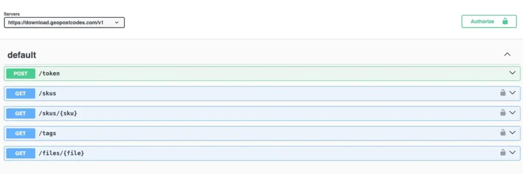
DEVELOPERS DOCUMENTATION
Our standard data format

Self-hosted
Our data can be downloaded and easily imported into any software, database, MDM, CRM, ERP, or GIS system.
Get automatic differential updates and full visibility on historical ID changes with our automated download delivery.
Flexible data formats include

Normalized
The Normalized tables provide unique and interrelated lists of the entities in the dataset: countries, administrative levels, cities, and postal codes. The tables are linked through record IDs. Constraints such as uniqueness, foreign keys, etc. ensure the integrity of the data.
Denormalized
The easiest format to integrate into your systems. All data are combined into one comprehensive table for immediate access.
Unlock the full potential of your location data

ZIP code database
Global dataset containing all administrative divisions, cities and ZIP codes for 247 countries.

Boundary data
A global data set of polygons representing postal codes and administrative areas.

Population Database
Global population estimates at zip code and administrative level covering a span of 55 years: past, present, and future.
Check our related articles


Frequently Asked Questions
A street address database organizes street addresses, localities, ZIP codes, administrative divisions, and structured address data into a unified source. A National Address Database—such as those created by certain governments—is maintained by public agencies to support national services, transportation safety, and infrastructure planning.
GeoPostcodes does not provide the USDOT National Address Database. Instead, our global dataset is built using curated, authoritative sources and includes street-level and address-level detail for international use cases. You can explore the full structure on our Streets Database product page.
Yes. The address database includes multilingual fields so users can work with street addresses in the languages defined by local authorities. While a national address database may focus on a single official language, our global solution supports regions with multiple scripts and language variants.
See our multilingual specifications on the Streets Database page.
Some regions—including rural areas, territories with tribal governance, or countries without formal address systems—don’t use standardized street addressing. In these cases, the GeoPostcodes address database relies on alternative references such as locality centroids, administrative divisions, or postal address proxies. This ensures organizations can still work with structured, normalized data even when no government-issued system exists.
For more on how we support global administrative structures, see our ZIP code Boundaries product.
Organizations use an address database to verify up-to-date street addresses, standardize incoming data, and support routing, geocoding, planning, and operational workflows. Public-sector agencies often rely on national address databases for infrastructure planning, school district analysis, and transportation safety.
GeoPostcodes supports both commercial and government use cases by providing global address coverage that integrates smoothly with open datasets. Learn how structured address data enhances geographic analysis in Zip Code Analysis.
A complete address database connects street addresses to postal addresses, administrative divisions, and post-office regions. This improves mail routing, reduces delivery errors, and ensures consistent addressing across regions. While some countries rely on official national address databases, our global dataset ensures standardized formatting for international delivery workflows.
To see how postal regions and administrative hierarchies are structured in our data, explore the Postal Codes product page.
Yes. USPS maintains a National Address Database (NAD) containing location information to support mail delivery and address validation. This dataset is produced by the U.S. Government. While it is not the same as GeoPostcodes’ global address database, many users compare the two when evaluating coverage, format consistency, and international applicability.
For differences in global postal systems, see ZIP Code vs Postcode: Key Differences.
Always up-to-date
Our data pipelines process more than 1,500 worldwide sources every day to capture postal and administrative changes as soon as they occur. This continuous workflow ensures our global ZIP code database is always up-to-date, with weekly releases available through our download API. Through long-standing partnerships with national and international postal operators, we deliver timely, accurate updates your systems can rely on.